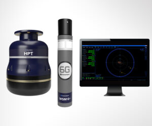
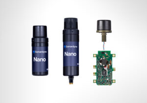
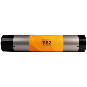
Showcase your capabilities
If you design, build or supply Diver Tracking Systems, create a profile to showcase your capabilities and connect with visitors who have an active requirement for your solutions.




Diver tracking systems provide surface teams with positional awareness of personnel operating underwater where direct GNSS positioning is unavailable. Systems may use USBL, SBL or LBL acoustic positioning, diver-carried navigation sensors, acoustic beacons, and surface-referenced GNSS data to establish and update diver locations.
This category features suppliers of diver tracking systems, supporting combat diving, port security, EOD and MCM, underwater inspection, surveillance, and search and rescue.
Read the Technology Overview


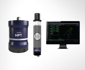
Undersea Sensing, Communications, Imaging, Control and Navigation Solutions for Naval Forces

Marine & Subsea Navigation, Positioning & Survey Technologies for Naval & Defense Applications

If you design, build or supply Diver Tracking Systems, create a profile to showcase your capabilities and connect with visitors who have an active requirement for your solutions.

Diver tracking systems provide surface teams with positional awareness of personnel operating below the waterline, where GNSS signals cannot be received directly. An underwater diver tracking system may use acoustic ranging, fixed reference points, surface positioning data, or diver-carried navigation sensors to establish and update a diver’s location.
For defense, security, and public safety organizations, diver tracking supports mission coordination, navigation, search operations, and personnel safety. Systems range from simple diver locator beacons to networked underwater diver positioning systems integrated with communications and mission planning equipment. The appropriate approach depends on factors such as accuracy, range, update rate, deployment time, depth, number of divers, and local acoustic conditions.
USBL systems determine the position of an underwater target using a compact acoustic transceiver array mounted on a vessel or surface platform. A diver transponder responds to acoustic interrogations, allowing the system to calculate range and direction. When combined with GNSS, heading, and platform motion data, USBL diver tracking can provide geographically referenced positions. It is particularly useful for mobile operations because it does not require a network of seabed reference stations.
Short baseline systems use multiple acoustic receivers or transducers separated across a vessel, structure, or temporary installation. The diver’s position is calculated from ranges or differences in signal arrival between the diver tracking transponder and the reference points. Accurate positioning depends on the known geometry of the array and, on mobile platforms, compensation for vessel position and movement. SBL systems require less underwater infrastructure than long baseline installations.
Long baseline systems use acoustic transponders positioned around an operational area, often on the seabed. A diver-carried unit or surface system measures ranges to several known reference points to calculate position. Because the reference network is independent of surface-vessel movement, LBL is well suited to repeatable positioning around subsea infrastructure, survey areas, and defined mission zones. Installation and calibration generally require more preparation than USBL.
Acoustic pingers and beacons provide a simpler way to locate divers or equipment underwater. A diver locator beacon transmits an identifiable acoustic signal that can be detected using hydrophones, directional receivers, or compatible tracking equipment. Depending on the receiver, the system may provide bearing, range, or a calculated position. An acoustic diver locator can serve as a primary tracking aid or as an emergency locating device if the main tracking system becomes unavailable.
A diver navigation system may combine heading, depth, inertial sensing, Doppler velocity measurements, acoustic positioning, and mission waypoints in a handheld or diver-worn package. These systems can support independent navigation while also reporting position to a surface team. Inertial and Doppler-based dead reckoning can maintain navigation between external fixes, although accumulated error may require periodic correction. Some systems integrate navigation, communications, and mission information into a common diver interface.
GNSS cannot provide a direct position fix to a submerged diver, but surface coordinates can provide a geographic reference for underwater tracking. A scuba diver tracking system may combine GNSS data from a boat or surface buoy with acoustic measurements to determine the diver’s position.
Other systems use a surface float connected to the diver. In this case, GNSS identifies the float directly and may only approximate the diver’s position unless factors such as tether length, depth, current, and relative geometry are considered.
Diver acoustic tracking systems can help supporting personnel monitor combat divers operating where navigation errors or loss of team awareness could affect a mission. Integration with communications and mission displays can support coordination, extraction planning, and monitoring of designated operating areas. Systems may also be configured to limit unnecessary acoustic transmissions where operational discretion is important.
Ports, naval facilities, and protected maritime infrastructure may use divers to inspect hulls, piers, barriers, and underwater approaches. Diver tracking helps supervisors monitor personnel and record which areas have been searched. Accurate positioning can also help teams return to suspected objects or previously inspected sections in poor visibility.
Reconnaissance divers may follow planned routes while collecting observations, imagery, or sensor data. An underwater diver positioning system can associate these observations with specific locations and provide surface personnel with a record of the mission track. This can support post-mission analysis and identify areas requiring further coverage.
Explosive Ordnance Disposal (EOD) and Mine Countermeasure (MCM) diving require controlled navigation and accurate location reporting. Tracking systems can help surface teams monitor a diver’s approach to a suspected object and record its position for further investigation or clearance. Diver location devices may also be integrated with sonar, underwater vehicles, and other mine countermeasure systems.
Divers inspecting ship hulls, offshore structures, pipelines, quay walls, and other submerged assets often need to record where observations were made. Position tracking can associate findings with geographic coordinates or local structural references, making it easier to revisit defects, compare inspections over time, or transfer information between teams.
A diver location system can record individual search tracks, helping recovery teams avoid unnecessary overlap and identify areas that remain unexamined. An underwater diver locator or acoustic beacon can also help surface personnel maintain awareness of divers working in poor visibility. Recorded tracks can support search planning and coordination between multiple divers.
During search and rescue operations, supervisors may need to monitor divers working in currents, restricted visibility, deep water, or large search areas. A scuba diver tracker can provide positional information alongside voice or data communications. An underwater diver locator beacon can provide an additional means of finding a diver whose precise position is no longer known.
Tracking and communications are often closely linked because positional data is more useful when surface personnel can also exchange instructions and status information with the diver. Acoustic communications can be affected by range, noise, reverberation, bandwidth, and local propagation conditions. Common integration options include:
Combining communications with diver tracking can reduce the number of separate systems an operator must monitor. Integrated systems can also associate position reports with diver identity, status, and mission information.
Development is increasingly focused on combining positioning, communications, navigation, and safety functions within integrated diver systems. Improvements in compact inertial sensors, acoustic processing, diver-worn electronics, and data integration are also supporting more continuous position estimates when direct acoustic fixes are temporarily unavailable. Areas of interest include:
Further integration of acoustic positioning, inertial navigation, digital communications, and diver-worn electronics can improve tracking continuity while reducing reliance on separate devices. Hybrid systems can also use one positioning method to compensate for the temporary limitations or accumulated errors of another.


 Searching Companies & Products


 Subscribe to the Weekly eBrief
The latest engineering and technical developments straight to your inbox - join thousands of engineers who receive it.
Subscribe to the Weekly eBrief
The latest engineering and technical developments straight to your inbox - join thousands of engineers who receive it.