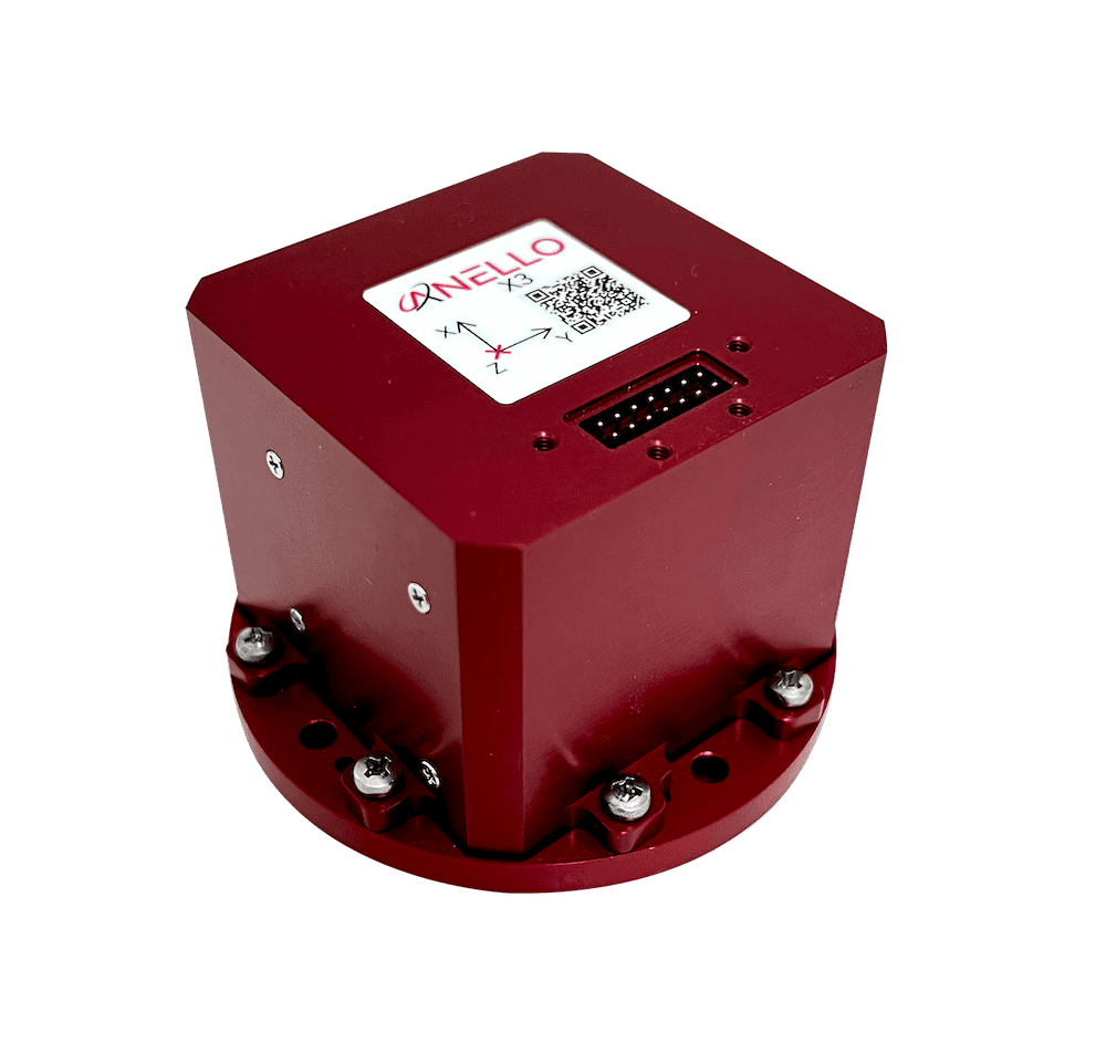




ANELLO Photonics is helping UAV operators strengthen navigation resilience with the ANELLO X3 IMU, designed to support GNSS denied operations without replacing established PX4 or ArduPilot flight control systems.
The article below from ANELLO examines how the X3 integrates with COTS flight controllers, the benefits of its optical gyro technology, and how higher performance inertial sensing can help maintain a credible navigation solution when GNSS becomes unavailable, while retaining flexibility to incorporate complementary sensors and navigation sources.
GNSS is the primary navigation reference for most UAV operations, but it cannot be assumed available or trustworthy at all times. Terrain masking, urban canyons, interference, jamming and spoofing can interrupt or corrupt satellite navigation. When that happens, the aircraft still needs a credible estimate of attitude, velocity and position.
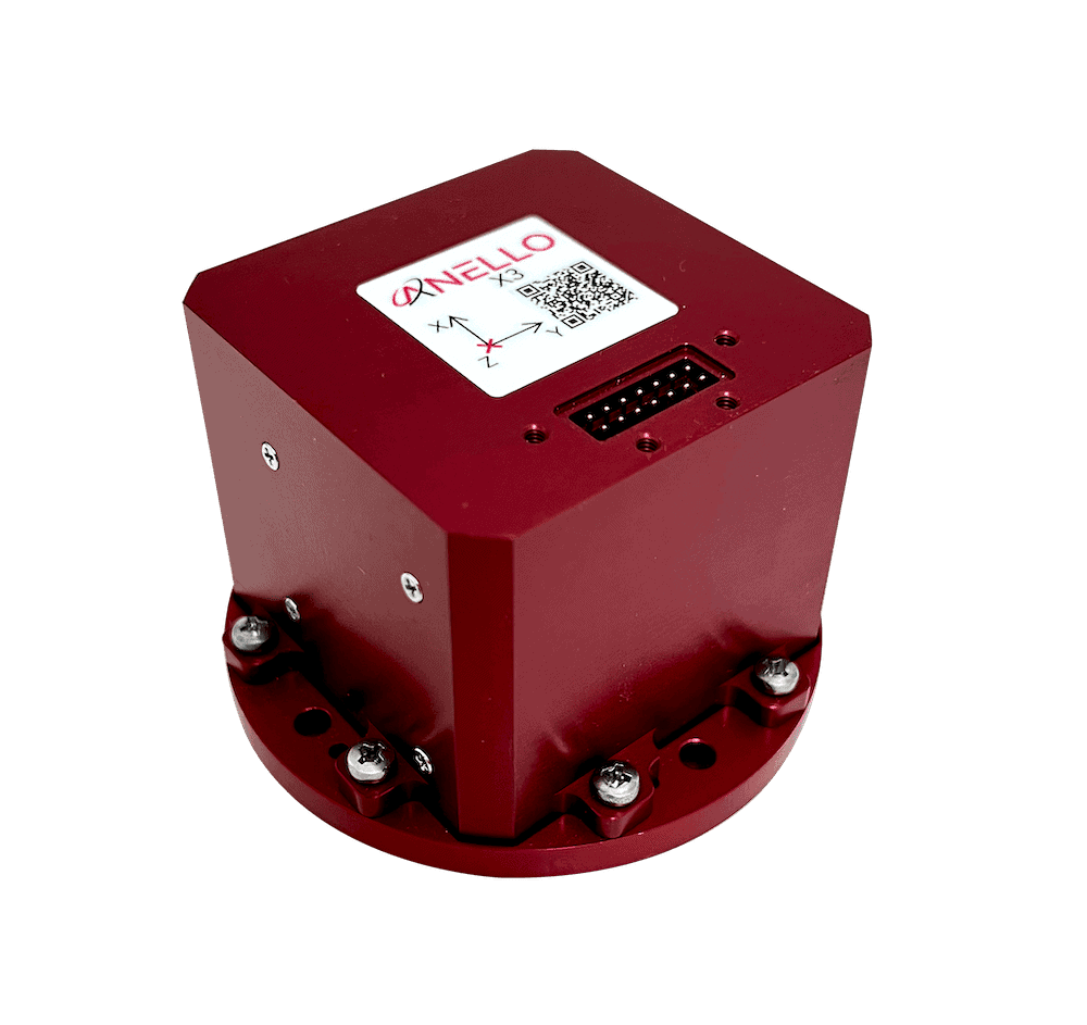
For teams already building on PX4 or ArduPilot, the ANELLO X3 IMU adds higher-performance inertial sensing without replacing the existing flight-control stack. The X3 uses three ANELLO SiPhOG™ optical gyroscopes, is designed for small SWaP-C, and communicates directly with a flight controller over a UART interface. The ANELLO X3 delivers gyroscopes with an angle random walk < 0.05°/√hr and bias instability < 0.5°/hr.
ANELLO provides drivers for both PX4 and ArduPilot. Integrators merge the appropriate driver into their flight-stack build, install the X3, configure it as the primary IMU, and tune the estimator with ANELLO support. The navigation solution itself remains inside the autopilot EKF.
Why This Architecture Matters
The main advantage is architectural simplicity. A team can keep a familiar COTS Pixhawk-class flight controller – for example, a Cube Orange-class system – and add X3 inertial performance rather than adopting a completely separate navigation computer. See design goals and what it means for the integrator below.
COTS flight control – Retain a Pixhawk-class autopilot and the existing PX4/ArduPilot ecosystem.
Small SWaP-C – Add GNSS-resilient inertial capability without a large external navigation computer.
UART integration – Connect the X3 directly to the flight controller through an available serial interface.
No external infrastructure – The inertial solution does not depend on beacons, maps, visual landmarks or a prepared operating area.
Environment-independent sensing – Unlike camera-dependent navigation, inertial sensing does not require lighting, visual texture or a visible ground scene; this is particularly valuable over water or in poor visibility.
Open ecosystem – PX4 and ArduPilot have large, active user and developer communities, making the solution extensible and familiar to many UAV teams.
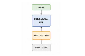
Figure 1. ANELLO X3 IMU integration with PX4/ArduPilot. The ANELLO X3 provides gyro and accelerometer data to the autopilot EKF, which fuses inertial measurements with GNSS and other aiding sources when available.
How The Integration Works
The integration can be reduced to four practical steps:
1. Merge the driver
Use the ANELLO-provided PX4 or ArduPilot driver in the target flight-stack build.
2. Connect the X3
Install the ANELLO X3 on the aircraft and connect it to power and an available UART on the flight controller. The X3 can run on 4.5 – 24 VDC at 5W. See the ANELLO X3 datasheet on our website for details.
3. Configure the estimator
Set up the flight stack so the autopilot EKF receives ANELLO X3 inertial data as the primary IMU. ANELLO can help with the recommended EKF configuration. You will also need to enter other details such as lever arms for best accuracy. Verify orientation, update rate, timestamps and estimator health.
4. Validate aided and unaided operation
First fly with good GNSS, then introduce controlled GNSS outages and measure drift and recovery behavior. The key point is that the X3 is not creating a separate black-box navigation solution that the autopilot merely consumes. The autopilot EKF creates the navigation solution using X3 gyro and accelerometer measurements directly. That gives the flight stack full access to the optical-gyro IMU data for estimation, control and other onboard functions.
What Happens When GNSS Disappears
During normal flight, GNSS provides an external position and velocity reference that continually constrains errors in the navigation solution. When GNSS becomes unavailable, that external reference is removed. The PX4 or ArduPilot EKF continues propagating the aircraft state using the IMU and any other aiding measurements that remain available, as illustrated in Figure 2.
At its simplest, this is dead reckoning: estimating where the aircraft is now based on where it was, how fast it was moving, and how its motion has changed since the previous update. The gyroscopes allow the estimator to track changes in aircraft attitude, while the accelerometers provide the measurements used to estimate changes in velocity. The estimator integrates these measurements over time to propagate velocity and position.
The challenge is that small inertial errors accumulate. Gyroscope performance is particularly important because accurate attitude estimation is required to interpret the accelerometer measurements correctly. The estimator must transform those measurements from the aircraft body frame into the navigation frame and account for gravity. Even a small attitude error can project part of the gravity vector into the horizontal plane, causing the estimator to interpret it as actual aircraft acceleration.
The resulting error can propagate through the navigation solution:
Gyro Error → Attitude Error → False Acceleration → Velocity Error → Position Drift
With GNSS available, external measurements continually help constrain these errors. Once GNSS is lost, the position solution becomes increasingly dependent on the quality and stability of the inertial measurements and on any remaining aiding sources. This is where a higher-performance IMU such as the ANELLO X3 can improve dead-reckoning performance without replacing the existing PX4 or ArduPilot estimator.
PX4 and ArduPilot EKFs are considerably more sophisticated than this simplified description: they estimate sensor biases, track uncertainty, perform consistency checks, and can fuse multiple aiding sources. Nevertheless, the underlying limitation remains the same: without an absolute position reference, inertial errors accumulate over time and the dead-reckoned position will drift.
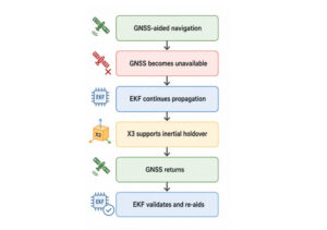
Figure 2. GNSS loss and dead-reckoning recovery workflow When GNSS is lost, the EKF continues propagating the state using X3 inertial data and any remaining aiding sources. When GNSS returns, the estimator validates the measurements before re-aiding the solution.
Where The Architecture Performs Best
The X3 can support multiple vehicle types, but fixed-wing UAVs with measured airspeed are particularly attractive for dead-reckoning applications. A pitot tube gives the EKF an additional motion constraint that can help bound parts of the navigation solution when GNSS is unavailable.
The broader principle is important: GNSS-denied does not have to mean completely unaided. The autopilot can combine X3 inertial data with complementary sensors such as airspeed, barometric altitude, magnetometers, range sensors, optical flow, vision or other navigation systems when the mission benefits from them.
This makes the architecture flexible rather than prescriptive. X3 provides a strong inertial core, while the integrator remains free to add complementary navigation sources for a specific CONOPS.
Why Inertial Holdover is Different from Camera-Based Navigation
Vision can be a powerful navigation aid, but it is inherently dependent on the external scene. Cameras may struggle over water, low-texture terrain, darkness, fog, smoke, glare or other poor-visibility conditions. They can also add compute, calibration and mission-planning requirements.
The X3 inertial path is different: it measures the aircraft’s own motion. It does not require a prepared environment, known landmarks or usable imagery. That makes it a useful navigation foundation for aircraft expected to operate across varied terrain, weather and lighting conditions.
This is not a claim of zero drift. Any unaided inertial solution accumulates error over time. The engineering objective is to extend the interval over which the dead-reckoned solution remains useful – and to measure that performance for the intended mission.
A Practical Validation Workflow
A good integration test should progress in stages rather than jumping directly to a long GNSS-denied flight:
Simulation
- Fly as normal, with full data logging for replay enabled from system on.
- Use replay to simulate GNSS outages.
- Verify flight solution is stable and navigation looks good.
Real-time
- Bench-check sensor orientation, signs, timing, update rate and UART reliability.
- Run stationary tests and confirm stable attitude, bias estimates and EKF health.
- Fly with normal GNSS while logging estimator innovations and X3 data.
- Introduce short, controlled GNSS outages, then increase outage duration. This can be done in real time by declaring GNSS as unhealthy over the data link.
- Measure horizontal drift, heading error and vertical error by comparing the reported navigation solution against the reported GNSS position over the telemetry link.
- Restore GNSS by declaring it healthy and confirm that the EKF validates and re-aids cleanly rather than producing an unsafe state jump.
The most useful result is not simply “the aircraft kept flying.” It is a quantitative curve showing how navigation error grows versus GNSS-outage duration under representative vehicle dynamics.
The Result: A Capable, Extensible GNSS-Resilient Platform
The combination of a COTS Pixhawk-class autopilot, PX4 or ArduPilot, and the ANELLO X3 IMU provides a route to GNSS-resilient navigation without discarding the flight-control stack teams already use. The autopilot retains ownership of the EKF and vehicle state, while gaining direct access to ANELLO X3 optical-gyro IMU data.
That architecture provides three advantages at once: a straightforward integration path, freedom from external navigation infrastructure, and an open framework for adding complementary navigation sources as mission requirements evolve.
See the ANELLO X3 IMU at Commercial UAV Expo in Las Vegas, September 1-3, 2026, Booth 1827.