Celestial navigation systems use observations of stars, the Sun, and other celestial bodies to provide independent positioning, attitude, and heading references for military platforms operating in GNSS-denied or contested environments. Solutions range from optical sextants and automated star trackers to integrated celestial-inertial navigation systems that combine astronomical measurements with inertial sensor data.
This page features suppliers of celestial navigation systems for military aircraft, naval vessels, submarines, long-range UAVs, missiles, and spacecraft.
If you design, build or supply Celestial Navigation Systems, create a profile to showcase your capabilities and connect with visitors who have an active requirement for your solutions.
Mission-critical navigation solutions for GPS-denied environments
Mission-critical navigation solutions for GPS-denied environments
...of alternative navigationsystems provides civilian and military manned and unmanned aircraft with... Vision-Aided NavigationSystem – compares data from live camera feeds to map data to provide a...
The Technical Guide to Celestial Navigation Systems for GNSS-Denied Operations
Overview by
William Mackenzie
Updated:
Introduction to Celestial Navigation Systems
Celestial navigation systems determine position, attitude, or heading using observations of stars, the Sun, and other celestial bodies. These systems provide independent astronomical references for positioning and navigation, supporting military operations where Global Navigation Satellite System (GNSS) signals are unavailable, jammed, or spoofed. Automated celestial navigation systems combine optical sensors, astronomical databases, precise timing, and navigation processing to identify celestial objects and derive navigation measurements.
Celestial navigation technology ranges from manual sextants and standalone star trackers to integrated celestial-inertial navigation systems. Applications include military aviation, naval navigation, long-range unmanned aircraft, missile guidance, and spacecraft attitude determination. System outputs depend on the observation method, with geographic positioning requiring additional references beyond stellar orientation alone. Performance is influenced by optical sensitivity, observation geometry, timing accuracy, platform motion, and atmospheric conditions.
Types of Celestial Navigation Systems
Celestial navigation systems use different observation and processing architectures depending on their required outputs, operational environment, and level of automation.
Type
Operating Principle
Characteristics
Defense Applications
Manual and Optical Sights (Sextants)
Measure the angular altitude of celestial bodies relative to a visible horizon or artificial reference using conventional or digital sextants.
Portable navigation instruments requiring accurate timing, astronomical reference data, and observation processing to establish position fixes.
Naval navigation, emergency positioning, and backup Positioning, Navigation, and Timing (PNT) operations.
Automated Star Trackers and Celestial Attitude Sensors
Use Charge-Coupled Device (CCD) or Complementary Metal-Oxide-Semiconductor (CMOS) imaging sensors to identify stellar patterns against stored star catalogs.
Provide precise attitude determination relative to celestial references. Geographic positioning requires additional measurements or navigation system integration.
Military satellites, spacecraft, and high-altitude platforms.
Celestial-Inertial Navigation Systems (CNS/INS)
Combine celestial observations with estimates from an Inertial Navigation System (INS) using sensor fusion algorithms, such as Kalman filtering.
Provide continuous inertial navigation, with celestial measurements used to constrain attitude errors and, where sufficient observations are available, position drift.
Long-range military aircraft, strategic missiles, and GNSS-denied aviation.
Terrestrial Automated Celestial Navigation Systems
Use optical celestial observations, precise timing, and orientation references to determine astronomical coordinates. Systems such as STELLA (System to Estimate Latitude and Longitude Astronomically) are associated with this positioning approach.
Can establish astronomical latitude and longitude without a visible horizon. Conversion to geodetic position requires appropriate reference models.
Military surveying, fixed-site position verification, and specialized terrestrial navigation applications.
Core Components of Celestial Navigation Systems
Automated celestial navigation systems combine optical, computational, and reference subsystems to acquire celestial observations and calculate navigation outputs. Key components include:
Optical Sensors and Imaging Assemblies: Cameras, lenses, and detectors capture celestial observations, with sensor sensitivity, field of view, and optical alignment influencing measurement accuracy.
Star Catalogs and Astronomical Databases: Stored reference information enables celestial object identification and calculation of apparent positions at the time of observation.
Navigation Processing Units: Embedded processors perform image analysis, celestial pattern matching, coordinate transformations, and navigation calculations to produce attitude or positioning measurements.
Precision Timing Systems: Accurate time references support astronomical position calculations and synchronization with other navigation sensors.
Inertial Measurement and Navigation Sensors: Gyroscopes and accelerometers measure angular motion and acceleration, supporting attitude estimation, motion compensation, and celestial-inertial integration.
Optical Filters and Protective Assemblies: Spectral filters, optical windows, and protective housings help manage background illumination and protect sensitive optical components from environmental exposure.
Sensor observations are matched with astronomical reference data to determine celestial directions. Navigation processing combines these measurements with timing, orientation, and other available references to generate the required attitude or positioning outputs.
Military Applications of Celestial Navigation Systems
Military Aircraft Navigation
Celestial-inertial systems provide independent astronomical references for long-range military aircraft operating without reliable GNSS signals. Integrated optical observations can correct attitude errors and, with suitable additional measurements, constrain accumulated inertial position errors. Airborne installations require adequate sky visibility, accurate optical alignment, and compensation for aircraft motion.
Naval Vessel Navigation
Naval vessels use celestial observations to establish independent position fixes and verify other navigation sources. Automated optical systems can reduce manual observation requirements and improve navigation resilience during satellite signal disruption. Shipboard performance depends on celestial visibility, vessel motion compensation, weather conditions, and unobstructed optical access.
Submarine Navigation and Position Verification
Submarines primarily rely on inertial navigation while submerged, as seawater prevents conventional optical observations of celestial bodies. Celestial positioning can provide an independent reference when a submarine surfaces or suitable optical equipment obtains an unobstructed view of the sky. These observations can support position verification and correction of accumulated inertial navigation errors.
Long-Range Unmanned Aerial Vehicle Navigation
Long-range Unmanned Aerial Vehicles (UAVs) can incorporate compact celestial sensors within multi-sensor navigation architectures. Celestial observations provide independent attitude references and can contribute to positioning when combined with suitable additional measurements. Integration requires consideration of size, weight, power consumption, vibration, and optical field of view.
Missile and Long-Range Weapon Navigation
Certain long-range missile navigation architectures combine inertial guidance with celestial measurements to reduce accumulated navigation errors. Optical star observations provide attitude references and, with appropriate additional measurements, can support position corrections. System integration must accommodate high-speed flight, platform dynamics, observation availability, and navigation processing requirements.
Spacecraft and Military Satellite Navigation
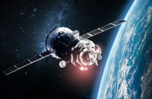
Military satellites and spacecraft employ star trackers for precise attitude determination, supporting pointing, stabilization, and orientation control. By identifying stellar patterns against onboard catalogs, these sensors establish orientation relative to known celestial references. Absolute spacecraft positioning generally requires additional navigation methods, such as orbit determination or external position measurements.
Celestial Navigation Compared with Alternative Navigation Technologies
Celestial navigation provides a complementary reference to other military PNT technologies, with different capabilities and operational constraints.
GNSS Navigation: Provides satellite-based position, velocity, and timing, but can be disrupted by interference or signal denial. Celestial navigation uses independent astronomical observations, although geographic positioning requires suitable timing and geometric references.
Standalone Inertial Navigation: Provides continuous navigation without external signals, although position and attitude errors can accumulate over time. Suitable celestial measurements can constrain attitude drift and support position correction within integrated navigation architectures.
Visual Terrain-Referenced Navigation: Estimates position by matching observed terrain or surface features against mapped references, whereas celestial systems use astronomical objects.
Magnetic Navigation: Uses Earth’s magnetic field for heading determination or position-related measurements, depending on the architecture, rather than optical celestial references.
Radar-Based Navigation: Uses radar observations of terrain, coastlines, or other features for localization, providing an alternative where celestial visibility is limited.
Multi-sensor navigation systems can combine these technologies to maintain navigation continuity under changing operational conditions.
Environmental & Military Qualification Requirements
Military celestial navigation equipment must meet environmental, electrical, and electromagnetic requirements appropriate to its installation. Relevant standards may include:
MIL-STD-810: Provides environmental test methods covering vibration, temperature, humidity, shock, and related stresses. Optical stability, sensor alignment, and image quality are important considerations for celestial navigation equipment.
MIL-STD-461: Establishes electromagnetic interference requirements for applicable military equipment. Testing addresses emissions and susceptibility associated with imaging sensors, processing electronics, and nearby platform transmitters.
MIL-STD-704: Defines aircraft electrical power characteristics relevant to compatible airborne installations. Navigation equipment must tolerate applicable power conditions and transitions without unacceptable performance degradation.
RTCA DO-160: Provides environmental and electromagnetic test procedures for airborne equipment, including temperature, vibration, power input, and radio-frequency susceptibility. It may be applicable to civil-certified or dual-use airborne installations.
Qualification requirements should be established according to the intended platform, installation location, and procurement specification rather than assumed from the navigation technology alone.
Developments in Celestial Navigation Technology
Developments in celestial navigation technology focus on improving automated observation capabilities, reducing equipment size, and extending operational availability. Key areas include:
Automated Star Identification: Advances in image-processing algorithms improve stellar detection, pattern matching, and rejection of false observations, particularly under challenging viewing conditions.
Daytime Celestial Navigation: Specialized detectors, optical filtering, and background suppression can enable stellar observations under daylight conditions in suitably designed systems. Performance remains dependent on atmospheric scattering and sky visibility.
Compact Optical Navigation Systems: Improvements in imaging sensors, optical assemblies, and embedded processing support reduced Size, Weight, and Power (SWaP) requirements for aircraft and unmanned platforms.
Celestial-Inertial Sensor Fusion: Improved estimation algorithms and integration techniques enhance the use of celestial attitude measurements alongside inertial and other navigation observations to constrain accumulated errors.
These developments support wider integration of automated celestial navigation systems into military platforms requiring independent navigation references during GNSS disruption.
The latest defense technology news, straight to your inbox.
Get our weekly roundup of technology developments, new products and industry news.
THANK YOU FOR SIGNING UP
Thanks for joining us. Check your inbox.
We've sent you an email. Click the confirmation link to complete your subscription to the weekly eBrief. In the meantime, explore the latest news, suppliers and technologies on DA.
Advancing Defense Capability Through Strategic Collaboration
Defense Advancement works with major OEMs to foster collaboration and increase engagement with SMEs, to accelerate innovation and drive defense capabilities forward.