Suppliers: GPS Denied Navigation

Advanced Navigation

Advanced Inertial Navigation Systems (INS) for Reliable Navigation in Challenging Operational Environments

ANELLO Photonics

Cutting-Edge Inertial Solutions for High-Accuracy Navigation & Positioning in GPS-Denied Environments

Honeywell Aerospace

Advanced Solutions for Defense Modernization: Propulsion, Sensors, Communication & Augmented Reality Systems

Inertial Labs, a VIAVI Solutions Company

Tactical Grade IMU, GPS/INS, Weapon Orientation Solutions

Psionic

Resilient Manned & Unmanned Navigation Solutions for GNSS-Denied Environments

Ground Control

Reliable, Resilient and Secure Satellite Communications & Assured PNT Solutions for Mission-Critical Applications

UAV Navigation-Grupo Oesía

State-Of-The-Art Flight Control & GNSS-Denied Navigation Technologies for Tactical UAV Platforms

EMCORE Corporation

High-Performance Fiber Optic, Ring Laser Gyro and MEMS Inertial Sensors & Navigation Systems

Silicon Sensing

MEMS Inertial Sensors, Gyroscopes & Accelerometers for Inertial Guidance, Control & Stabilization

Septentrio

Assured PNT Solutions for Mission Critical Military, Defense & Government Applications

UAV Propulsion Tech

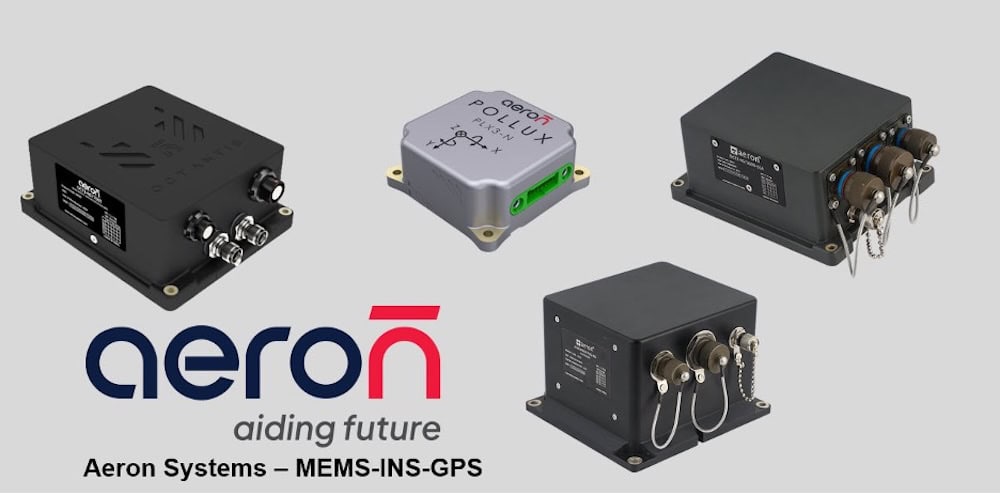
MEMS-based Inertial Navigation Systems for Supporting Tactical Unmanned Operations in GPS-Denied Environments

Showcase your capabilities

If you design, build or supply GPS Denied Navigation, create a profile to showcase your capabilities and connect with visitors who have an active requirement for your solutions.

Create Supplier Profile

Products

18 Cutting-edge Solutions
Add your solutions
Chimera Land

Laser velocity sensing for assured navigation in GNSS-denied operations

Laser velocity sensing for assured navigation in GNSS-denied operations
...s operating in GNSS-denied, jammed, or spoofed environments. Using infrared laser Doppler... ......icle motion, capturing dynamics such as vibration and wheel slip that affect navigation accuracy....
Boreas D90

Digital FOG INS with dual-antenna RTK GNSS

Digital FOG INS with dual-antenna RTK GNSS
...al-antenna RTK GNSS receiver. These are coupled through an AI-driven sensor fusion algorithm that...
ANELLO Aerial INS

High-performance inertial navigation system for autonomous aerial missions in GPS-denied environment

High-performance inertial navigation system for autonomous aerial missions in GPS-denied environment
...ision inertial navigation system developed to deliver reliable positional data and attitude accuracy...
ANELLO Ground INS

Long-term high-accuracy navigation for GPS-denied environments

Long-term high-accuracy navigation for GPS-denied environments
... high-accuracy navigation performance during jamming and spoofing attacks and other GNSS-denied...
ANELLO Maritime INS

Ultra-reliable navigation for surface and underwater naval platforms

Ultra-reliable navigation for surface and underwater naval platforms
...high-precision navigation for surface and subsurface naval and marine platforms such as ASVs...
ANELLO GNSS INS/ATAK

Real-time GPS-denied navigation for ATAK systems

Real-time GPS-denied navigation for ATAK systems
The ANELLO GNSS INS/ATAK (Android Tactical Awareness Kit) is designed to support the warfighter in...
M-AJ-QUATRO

Advanced CRPA antenna system for A-PNT operations in GNSS-denied environments

Advanced CRPA antenna system for A-PNT operations in GNSS-denied environments
...d positioning, navigation, and timing (A-PNT) in electromagnetically contested environments.... ...ibility across GPS, GLONASS, GALILEO, BEIDOU, and QZSS, and seamless integration with Inertial...
INS-BU

Basic single-antenna GNSS-INS with u-blox receiver

Basic single-antenna GNSS-INS with u-blox receiver
...dustrial-grade GNSS-aided inertial navigation system that is highly suited to marine, land and... ......Applications: Low-Cost Precision Agriculture; Low-Cost Land Vehicle Navigation
Resilient Navigation System

Multi-tiered system for secure UAV navigation in GNSS-denied environments

Multi-tiered system for secure UAV navigation in GNSS-denied environments
...well Resilient Navigation System is a low-SWaP solution that utilizes three different technologies... ...... The three layers of the Resilient Navigation System include:
Alternative Navigation Systems

Mission-critical navigation solutions for GPS-denied environments

Mission-critical navigation solutions for GPS-denied environments
...of alternative navigation systems provides civilian and military manned and unmanned aircraft with... Vision-Aided Navigation System – compares data from live camera feeds to map data to provide a...
Embedded GPS/INS with anti-jamming capabilities

High-performance certified solutions for military navigation requirements

High-performance certified solutions for military navigation requirements
...l’s Embedded GPS/INS (EGI) systems are designed to provide military aircraft with the utmost in...
SurePath Ground-V

Precision navigation for military and commercial vehicles in GNSS-denied & contested environments

Precision navigation for military and commercial vehicles in GNSS-denied & contested environments
...formance under GNSS-denied and degraded conditions, measuring surface-relative velocity with the... ... with existing GNSS and inertial navigation sensor architectures. It provides RS-422, CAN and...
RockBLOCK APNT

Rugged Iridium PNT module for unmanned systems & military equipment

Rugged Iridium PNT module for unmanned systems & military equipment
...er challenging GNSS-denied conditions. Enabling reliable two-way communication anywhere on the...
GNSS-Denied Navigation Kit

Combined inertial & visual navigation for GNSS-denied environments

Combined inertial & visual navigation for GNSS-denied environments
The GNSS-Denied Navigation Kit combines an advanced AHRS and Visual Navigation System with a...
POLAR-300

MEMS-based AHRS & INS unit with air data system for UAVs

MEMS-based AHRS & INS unit with air data system for UAVs
...dead reckoning navigation in dynamic environments. It is ideal for integration into UAV avionics...
POLAR-500

AHRS & INS unit with air data system & dual GNSS compass

AHRS & INS unit with air data system & dual GNSS compass
...porates a dual GNSS compass, providing precise attitude and heading estimation capabilities under...
VNS01

Visual navigation system for NATO Category I & II UAS

Visual navigation system for NATO Category I & II UAS
The Visual Navigation System (VNS01) utilizes an onboard camera and sophisticated visual odometry...
Inertial Navigation Systems

Military-ready MEMS INS & inertial sensors for unmanned platforms

Military-ready MEMS INS & inertial sensors for unmanned platforms
...based inertial navigation systems used in tactical UAVs and unmanned platforms for defense and... ... near-tactical navigation performance...

GNSS/GPS-Denied Navigation and Positioning Solutions

Olivia Hannam

Updated:

GPS/GNSS-denied navigation allows military vehicles and autonomous platforms to determine their position and movement in environments where global navigation satellite systems are unavailable, jammed, or spoofed.

These environments are increasingly common in modern combat zones, especially where adversaries deploy electronic warfare measures.

Without reliable satellite signals, unmanned systems require alternative solutions that combine inertial measurement, environmental sensing, mapping, and algorithmic estimation. These solutions are often tailored to the operating domain, land, air, sea, or subsurface, and optimized for resilience, accuracy, and real-time responsiveness.

Drone navigation from Honeywell

HGuide o480 inertial/GNSS for drone navigation from Honeywell.

Key GNSS-denied Applications

GNSS-denied capabilities are vital across multiple mission types. The following domains represent the primary defense applications for these technologies:

Unmanned Aerial Vehicles in Contested Airspace

Military UAS (Unmanned Aerial Systems) are often deployed in anti-access/area-denial (A2/AD) zones where GNSS spoofing and jamming are expected. In these missions, UAVs rely on inertial navigation systems, terrain-referenced navigation, visual odometry, and SLAM to maintain flight control, execute precision targeting, or conduct ISR without satellite support.

Applications include long-endurance reconnaissance, tactical mapping, loitering munitions, and drone swarm coordination, all requiring independent navigation resilience.

Ground Robotics for Urban and Subterranean Operations

Urban canyons can cause multi-path distortion or a complete loss of signal. In these settings, Unmanned Ground Vehicles (UGVs) use tactical-grade IMUs, LIDAR sensors, radar, and SLAM algorithms to support:

These platforms must be capable of operating in GPS-denied corridors, underpasses, basements, or confined infrastructure environments.

Subterranean and Tunnel Reconnaissance

Specialized unmanned systems are deployed for subterranean exploration in denied areas, such as tunnel networks, cave complexes, or hardened military structures. These vehicles must navigate without access to GNSS and are equipped with sensor packages for mapping, localization, and structural analysis.

They are used for:

  • Border tunnel detection
  • Hostile underground facility mapping
  • Disaster response in collapsed infrastructure

Underwater and Littoral Navigation

GNSS signals do not penetrate water, making all underwater operations inherently GPS-denied. Unmanned Underwater Vehicles (UUVs) use Doppler velocity logs (DVLs), inertial sensors, bathymetric maps, and acoustic beacons for navigation.

Applications include:

  • Mine countermeasures
  • Harbor and coastal surveillance
  • Seabed infrastructure monitoring
  • Covert ISR operations

Tactical Operations and Dismounted Soldier Navigation

Handheld or body-worn navigation tools are essential for troops operating in electronic warfare zones or GNSS-degraded environments. These tools use dead reckoning, magnetometers, and terrain data to guide operators silently and precisely.

Such systems are designed for:

  • Special operations forces in denied areas
  • Covert ingress/egress routes
  • RF-silent navigation
Inertial measurement units from Inertial Labs

MEMS Inertial Measurement Unit, IMU-H100, for drone, submarine, and autonomous vehicle navigation, by Inertial Labs.

Autonomous Logistics and Resupply

Unmanned logistics vehicles support mission sustainment in GNSS-contested regions. Ground or aerial resupply platforms use preloaded routes, obstacle detection, and terrain-following algorithms to complete deliveries in hostile environments.

Common use cases include:

  • Autonomous cargo delivery to front-line units
  • Medical supply drops in electronic warfare zones
  • Low-profile logistics missions in denied airspace
  • Navigation Technologies Supporting GNSS-Denied Operations

GNSS-denied systems integrate multiple sensor modalities and computational methods to achieve accurate navigation. Core technologies include:

  • Inertial Navigation Systems (INS): Gyroscopes and accelerometers for dead reckoning
  • Magnetometers: Compass-like orientation tools resistant to satellite loss
  • Visual Odometry: Motion tracking via optical image analysis, including the use of optical flow sensors for pixel-level motion estimation
  • LIDAR and Radar Sensors: Environmental scanning for terrain-relative positioning
  • Acoustic Navigation: Used in underwater environments with sonar or DVLs
  • SLAM Algorithms: Real-time mapping and localization
  • Timing Modules: OCXOs or chip-scale atomic clocks for time synchronization
  • Sensor Fusion Frameworks: Combining multiple data sources for accurate localization

Types of GNSS/GPS-Denied Systems

GNSS-denied capabilities vary by mission and platform. Key system types include:

  • UAV Navigation Modules: For strike and ISR drones in contested airspace
  • UGV SLAM Systems: Designed for robotic ground platforms in complex terrain
  • Underwater Navigation Suites: Tailored to UUVs for fully submerged operation
  • Wearable Navigation Kits: Compact tools for dismounted troops
  • Swarm Coordination Systems: Internal navigation logic for multi-agent autonomous ops

Industry Standards and Defense Specifications

GNSS-denied navigation systems must meet rigorous defense standards to ensure performance and interoperability. Commonly applied standards include:

  • MIL-STD-810: Environmental test standards for vibration, temperature, and shock
  • MIL-STD-1553 / 1760: Communication protocols for avionics and weapons interfaces
  • MIL-STD-461: Electromagnetic compatibility (EMC) requirements
  • STANAG 4586: NATO standard for UAV interoperability
  • DO-178C / DO-254: Applicable for certified aerospace-grade software and hardware

These standards ensure reliability in extreme operational environments and allow integration with existing command-and-control frameworks.

Comparisons with Traditional GNSS-Based Systems

Traditional navigation systems rely heavily on GNSS constellations such as GPS, GLONASS, Galileo, and BeiDou. While effective in open and stable environments, these systems are vulnerable to:

  • Signal jamming or spoofing
  • Multipath distortion in urban terrain
  • Denial in underground or underwater domains
  • Tactical exposure due to RF emissions

GNSS-denied systems mitigate these vulnerabilities through internal sensing, passive data acquisition, and terrain-based localization, offering resilience and independence from space-based infrastructure.

Strategic Importance of GNSS-Denied Navigation

As military forces become more reliant on autonomous and semi-autonomous systems, the ability to operate in GNSS-denied conditions is essential for mission assurance. Adversarial threats to satellite infrastructure and increasing electronic warfare capabilities highlight the strategic need for resilient, modular, and signal-independent navigation systems.

GNSS-denied solutions support operational flexibility, enhance survivability, and ensure mission continuity across domains, land, air, sea, and subsurface.

Related Articles

ANELLO Maritime INS for Resilient GPS-Denied Navigation

ANELLO Photonics outlines how its Maritime INS combines SiPhOG™ optical gyroscope technology, multi-sensor fusion, and real-time state estimation to support resilient maritime navigation during GPS jamming, spoofing, signal degradation, and GNSS-denied operations

May 29, 2026
ANELLO Secures $25M Series B-2 Funding for GPS Denied-Navigation

ANELLO Photonics has raised $25 million in an oversubscribed Series B-2 funding round to scale production and deployment of its silicon photonics-based inertial navigation systems for GPS-denied and contested environments

May 06, 2026
ANELLO Maritime INS Selected for Autonomous Navigation

ANELLO Photonics’ Maritime Inertial Navigation System has been selected by BlackSea Technologies for integration into an autonomous surface vessel, delivering assured, high-precision navigation in GNSS-denied and contested maritime environments

Apr 24, 2026
Army Contract Awarded for Vector AI sUAS & Enhanced Tactical Intelligence

Quantum-Systems secures U.S. Army contract to supply Vector AI eVTOL sUAS, delivering reconnaissance, surveillance, and target acquisition capabilities with GPS-independent navigation, anti-jamming resilience, and rapid deployment for tactical operations

Apr 22, 2026
Inertial Labs Showcased GNSS-Denied Navigation Solutions at World Defense Show 2026

Inertial Labs recently showcased advanced inertial navigation and GNSS-denied technologies at the World Defense Show 2026, enhancing precision positioning and mission-critical performance across autonomous defense platforms

Apr 16, 2026
Advanced Navigation Addresses Inertial Navigation for C-UAS in GPS-Denied Environments

Advanced Navigation outlines how inertial navigation systems maintain radar and effector synchronization in GPS-denied environments to support reliable counter-UAS tracking and engagement under electronic warfare conditions

Apr 14, 2026
Visual Inertial Navigation for UAV Operation in GNSS Denied & Contested Environments

Inertial Labs outlines its Visual Inertial Navigation System (VINS), which enhances UAV navigation performance in GNSS-denied and contested environments through the integration of inertial sensing and visual odometry

Apr 13, 2026
EDGE Microwave Details GNSS Signal Vulnerability & Mitigation Approaches

EDGE Microwave outlines how GNSS signals are vulnerable to interference, exploring impacts across key operational domains and the mitigation approaches used to ensure reliable positioning, navigation, and timing

Apr 10, 2026
Advanced Navigation Highlights GNSS Spoofing Risks & INS-Based Mitigation

Advanced Navigation examines GNSS spoofing risks to commercial and autonomous systems, showing how inertial navigation systems with electronic protection ensure resilient positioning, navigation, and timing in contested environments

Apr 02, 2026