Trailblazers in positioning, navigation, pointing, and platform stabilization solutions and inertial orientation technologies for 20 years, Inertial Labs creates cutting-edge inertial solutions for air, land, and sea.
Our team serves and consults clients across defense applications, solving today’s problems and planning for how we can unravel those of tomorrow.
From government, defense, and aerospace, Inertial Labs is at the forefront of developing and customizing products for cutting-edge technologies. These include Inertial Measuring, Magnetic Compensation, GNSS Tracking, Navigation in GNSS-denied, Platform Stabilization, Weapon Orientation and Pointing, LiDAR Scanning, Optical Image Processing, Acoustic, Ultra-wideband RF, Celestial/Solar Compassing and many more.
Certifications
Our manufacturing partners are certified to meet the standards set by the electronics industry. As a result, our clients get more than incredible service. They also get the highest quality products. Here’s a list of our top honors:
- ISO 9001:2015 Certified
- ISO 9001:2008 Certified
- ISO 13485:2012 Certified
- MIL-STD-I-454 Requirement 5 and 9
- J-STD-001 (Class 1, 2 & 3)
- IPC-A-610 (Class 1, 2 & 3)
- IPC-A-620 (Class 1, 2 & 3)
- IPC/WHMA-A-620 (Class 1, 2 & 3)
- IPC 2221

WOM – Weapons Orientation Modules
Built for Military Performance
The WOM weapon orientation modules provides a level of performance previously unseen in the world of miniature 3DOF orientation systems. WOM employs the use of three axes each of gyroscopes, accelerometers, and magnetometers to track both slow and fast movements of weapons in real-time. It houses propriety calibration techniques for soft- and hard-iron interference that are specific to the different weapon classes on which it can be used. Calibrations can be performed quickly and easily by minimally trained individuals without requiring any precise movements.
The optical tracking within OptoWOM-II works through the use of reference images. A reference image is literally a picture of the horizon in a given direction. Within the reference image the system identifies a constellation of identifiable features. Then, from any subsequent image collected by the camera, heading is determined by comparing those images back to the most appropriate reference. As long as the system can identify 10% of a previously collected reference, it can provide an accurate assessment of the change in heading.
Take advantage of either one of these platforms with embedded features such as the ‘on-the-fly’ magnetic calibration, built-in point-light tracking capabilities, embedded weapon fire indicators, and available SDK packages.
Use Cases for the WOM
Weapon Aiming Systems
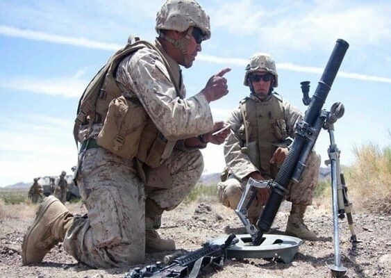
Typically comprised of a gun (M16, M4, M240, or M249) mounted to a pivoting surface, any weapons aiming system needs to be controlled by tactical and reliable grade sensor solutions. With the MIL-STD rating in both vibration and shock the WOM and OptoWOM-II can handle extreme conditions including heavy grenade (M203 or M320) and mortar systems (M224, M252 or M120). Inertial Labs has partnered on many occasions, bringing high-quality optically stabilized systems to the United States Military for weapon aiming contracts.
Remote Weapon Stations (RWS)
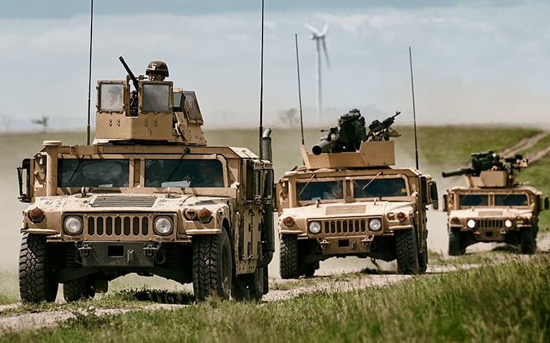
A Remote Weapon Station (RWS), or commonly known as a Remote Controlled Weapon Station (RCWS) is used as a military oriented fire-control system for both light and medium caliber weapons (30, 60, 81, 105 and 120 mm), from turret response systems to anti-tank weapon platforms. This remotely operated system can be used seamlessly as the main mission response sensor, even in the line of fire. RWS are most commonly used in modern military vehicles, this system features many additional sensors including an IMU, Optical Aiding Data, GNSS receiver for heading calculations and object recognition software.
Stabilized Fire Control (Day and Night)
Commonly used in reconnaissance or tactical response teams, Fire Control is a method of aiming and firing projectiles where the operator does not rely on a direct line of sight between the target and the turret. Fire Control systems have now incorporated optical data to stabilize heading drift without the need of GPS/GNSS receivers. The OptoWOM-II by Inertial Labs was developed responding to the need for stabilized heading in both day and night operations, even when there may be unavoidable local magnetic interference. Special algorithms have been developed especially for using the OptoWOM-II with artillery in the field.
WOM Demonstration
Inertial Labs demonstrates the operation and performance of its OptoWOM-II Weapon Aiming System.
Performance Characteristics for the WOM
WOM Heading, Pitch and Roll AccuracyNote: Accuracy here is in degrees, not mils. The standard conversion rate is 1 mil = 0.05625°.
TAG – Two and Three Axis Gyroscopes

The Inertial Labs Two and Three Axis Gyroscopes (TAG-200 and TAG-300) are developed for Electro-Optical Systems, Gimbals, Line-of-Sight and Pan & Tilt Platforms for stabilization and pointing applications. These devices utilize advanced, tactical-grade MEMS sensitive of which size, power consumption, reliability, and performance are ideal for accomplishing complex tasks requiring accurate stabilization of assorted platforms.
Both the TAG-200 and TAG-300 are factory calibrated over their operational temperature range and precision machined to ensure very low non-orthogonality and misalignment between sensitive elements. Additionally these items are ITAR-free and exportable (ECCN 7A994) to available countries. Each unit is supplied with individual Calibration and Acceptance Test Certificates and goes through extensive Quality Assurance and Quality Compliance procedures to ensure product reliability before they are shipped.
The Inertial Labs team of skilled engineers provides expertise to help users select and configure from the models available: TAG-200 and TAG300. Our skilled support team helps set up units for all application bases to satisfy both environmental and circumstantial project requirements.
Two and Three Axis Gyro Use Cases
The Inertial Labs Two and Three Axis Gyros have been commonly used for the following applications
Remote Weapon Stations (RWS) Stabilization
A Remote Weapon Station (RWS), or otherwise known as a Remote Controlled Weapon Station (RCWS) is a commonly used military oriented fire-control system for both light and medium caliber weapons. An RWS can be used in simulating fire control systems for training purposes as well as main missions in the line of fire. The TAG-200 and TAG-300 are commonly used to stabilize these platforms and can be integrated with additional components such as: Optical Aiding Data (stereo cameras), GNSS receivers for heading calculations or object recognition software.
Optical Image Stabilization (2D and 3D)
Easily integrate with electro-optical systems to stabilize platforms and use information supplied by the TAG for object recognition, detection, and end-to-end response systems. Computer vision systems utilize data streams from the Inertial Labs TAG to correctly identify target position, range distance, and angle of elevation.
Stabilization and Anti-Roll Systems
The Three Axis Gyroscope is an ideal stabilization and anti-roll solution in both static and dynamic applications. In the aerospace industry the TAG-300 is ideal for gimbaled rocket engines to vector thrust in different directions. For land vehicles, utilize the TAG-200 for stabilizing independently operated remote weapons stations and offsetting vehicle pitch and roll.
IMU – Inertial Measurement Units

The Inertial Labs Inertial Measurement Units (IMU) each contain 3 highly accurate advanced MEMS gyroscopes and 3 high-performance accelerometers. To achieve maximum usability for end-users, the IMU-P, and Kernel are both temperature calibrated within its operational temperature range. This also ensures tactical grade performance regardless of the environment it is being used in.
These IMU’s are a cost-effective ITAR-free solution for systems that may have previously only used Fiber-Optic Gyroscopes (FOG’s) as the primary solution. By using extensive calibration methods and developing a robust Kalman Filter, Inertial Labs developed the IMU-P and the Kernel product lines to compete in performance with many FOG units on the market.
The Inertial Labs team of skilled engineers provides expertise to help users select and configure from the models available: IMU-P Industrial, IMU-P Tactical (Stabilization), IMU-P Tactical (Standard) and Kernel-100. Reach out to our support team for help integrating your unit, or visit our Knowledge Base to view answers to frequently asked questions.
IMU Use Cases
The Inertial Labs Inertial Measurement Units have been commonly used for the following applications
Antenna and Line of Sight Stabilization
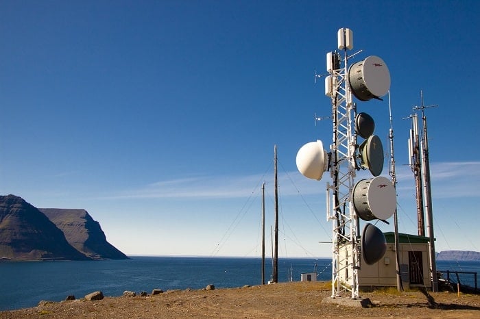
Stabilize unwanted antenna movement caused by wind, motion, or friction on platforms. Additionally utilize the IMU-P for it’s easy integration in antenna tracking systems. Whether you are tracking from satellites or RF transmissions, the IMU-P easily mounts to any surface and generates custom data output formats commonly used with Line of Sight (LOS) and Beyond Line of Sight (BLOS) antenna transmission systems.
Motion Control Sensors (MCS) and Gimbaled Actuators
The IMU-P is an ideal motion control solution in both static and dynamic applications. In the aerospace industry the tactical version of the IMU-P is ideal for gimbaled engines to vector thrust in different directions. Additionally, it’s commonly used in warehouses and construction sites on Mobile Elevated Work Platforms (MEWP’s) to counted and offset unwanted or unsafe tilt.
Low Cost Replacement for Fiber Optic Gyroscope (FOG) Units
Replacing existing sensors is not as easy as purchasing a new sensor and plugging it into the existing hardware. There are many other factors that companies must consider as they seek replacement solutions, and they typically are both costly and time-consuming. Inertial Labs wants to reduce R&D and programming time for customers seeking replacement solutions for discontinued sensors. We develop low-cost alternatives to dated FOG units by creating custom form-fitting solutions to meet end user needs in both performance and functionality.
Electro-Optical Components (EOC and IR)
Easily integrate with electro-optical systems and use for object recognition, detection, and end-to-end response systems. Commonly used in military and security divisions, Inertial Labs has partnered with many companies such as Openworks Engineering to develop custom solutions for target detection and response. Computer vision systems utilize data streams from the Inertial Labs IMU-P to correctly identify target position, range distance, and angle of elevation. Response systems, utilizing orientation data from the IMU-P, then take actions necessary to protect user assets.
Passenger Train Monitoring and Track Inspection Systems
Complying with EN 50121-3-2 and EN 61000-6-1/3, Inertial Labs products, particularly the Tactical Grade IMU-P make the perfect solution for passenger train acceleration monitoring systems and track inspection payloads. Orientation data fused with optical recognition hardware and software is used to correctly identify and alert operators of potential threats to passenger safety. Whether its monitoring the speed and acceleration of the train, or aiding in track inspections to identify crack propagation, the IMU-P ensures safety and is a critical element for all inspection platforms.
Attitude and Heading Reference Systems (AHRS)

Beginning in 2001, Inertial Labs began manufacturing it’s MEMS based, IP-67 sealed, MIL-STD-810G qualified, multiple interfaces and COM ports Attitude and Heading Reference System responding to the need for an inclusive and price competitive Antenna Pointing, Aiming, and Stabilizing applications. Each INS contains an Inertial Labs developed Tactical or Industrial-grade Inertial Measurement Units (IMU) and an Inertial Labs manufactured high-precision Fluxgate Magnetometer.
The Inertial Labs team of skilled engineers provides expertise to help users select and configure from the models available: AHRS-10B, AHRS-10P, AHRS-II-P, and OptoAHRS-II. Our support team helps set up units for all application bases to satisfy both GNSS enabled, and GNSS-denied environments.
Use Cases for the AHRS
The Inertial Labs Attitude and Heading Reference System (AHRS) has been commonly used for the following applications
Remote Sensing with LiDAR
Sometimes called a 3D laser scanner, LiDAR is a surveying instrument that measures distance to a target by illuminating the target with pulsed laser light and measuring the reflected pulses with a sensor. It has terrestrial, airborne, and mobile applications. Some models of 3D LiDAR are able to generate up to 700,000 data points per second, There are plenty of exceptional producers on the market, for example Quanergy®(2) and Velodyne®.
Remote Weapon Stations (RWS)
A Remote Weapon Station (RWS), or otherwise known as a Remote Controlled Weapon Station (RCWS) is a commonly used military oriented fire-control system for both light and medium caliber weapons. This remotely operated system can be used in simulating fire control systems for training purposes as well as main missions in the line of fire. Most commonly used in modern military vehicles this system features many additional sensors including: an IMU, Optical Aiding Data, GNSS receiver for heading calculations and object recognition software.
Indirect Fire Control
Commonly used in simulating field work, Indirect Fire Control is a method of aiming and firing some projectile where the operator does not rely on a direct line of sight between the target and the turret. Indirect Fire Control systems have now incorporated optical data to stabilize heading drift without the need of GPS/GNSS receivers. The OptoAHRS-II by Inertial Labs was developed in response and has algorithms developed especially for using with artillery in the training field.
Aiding Data Navigation Solution
A navigation solution in its simpliest form requires information from external sources to compute the necessary calculations and return attitude, position, velocity, and time with high precision. The AHRS-II-P is Inertial Labs solution to end users who have many sensor components on board already, but need a hardware component that is able to filter out noise, improve accuracy with its Robust Kalman Filter and output a complete navigation solution.
Antenna Pointing
Used for both Line of Sight (LOS) and Beyond Line of Sight (BLOS) applications, the AHRS is the ideal low-cost solution for ensuring that communication hardware is oriented and being directed in the proper direction. Communication between land and shore and vehicle to ground station is vital for both commercial and military applications, and Inertial Labs has the necessary sensor solution for it.
Platform Stabilization
Typically comprised of a support frame, a carrier platform, isolators and sensor systems, platforms stabilization is a common use case of the AHRS in both marine, and industrial applications. For high-rise workers at the construction cite or engineers accounting for offsets on a developing pan and tilt system, the AHRS is the perfect solution for the job.
Antenna Reference Unit (ARU)
Similarly to how an Inertial Reference unit (IRU) determines an aircraft’s change in rotational attitude, an Antenna Reference Unit simply determines and calculates orientation (attitude) offsets for a antenna being used commonly on static platforms and dynamic ground vehicles. Unlike gimbaled systems, Inertial Labs strapdown system is lighter, smaller and consumes much less power, making it the perfect solution as an ARU.
Performance Characteristics for the AHRS
Professional AHRS Heading, Pitch and Roll AccuracyUnboxing the AHRS-10P
Single and Dual Antenna GPS-Aided Inertial Navigation Systems (INS)

The unveiling of the INS began in 2001 when Inertial Labs began manufacturing it’s first MEMS based, IP-67 sealed (later releasing OEM Navigation System versions), MIL-STD-810G qualified, multiple interfaces and COM ports Single and Dual Antenna GPS-Aided Inertial Navigation Systems (INS). Each INS contains an Inertial Labs developed Tactical or Industrial-grade Inertial Measurement Units (IMU) and reliable single or dual GNSS receiver from suppliers like NovAtel, Hemisphere, and uBlox.
The professional model of INS, the INS-P utilizes an embedded, high-precision, gyro-compensated magnetic compass, which allows the navigation system to measure and output high-precision Heading without GNSS signal even in extreme environmental conditions (temperature, vibration, interference from external magnetic field).
The Inertial Labs team of skilled engineers provides expertise to help users select and configure from the models available: INS-B, INS-U, INS-BU, INS-P, INS-D, INS-DU and INS-DL. Our support team helps set up units for all application bases to satisfy both GNSS-enabled, and GNSS-denied environments.
Use Cases for the Inertial Navigation System
Scanning and Mapping
Perhaps area mapping is still the biggest domain for remote sensing. Making sense of the physical world by analyzing maps and 3D models allows businesses to make faster and more informed decisions that increase efficiency, profit and more importantly, improve safety. A few of the most often used bases it can be done on are a land vehicle or Unmanned Aerial Vehicles (UAV).
Unmanned Aerial Vehicles (UAV)
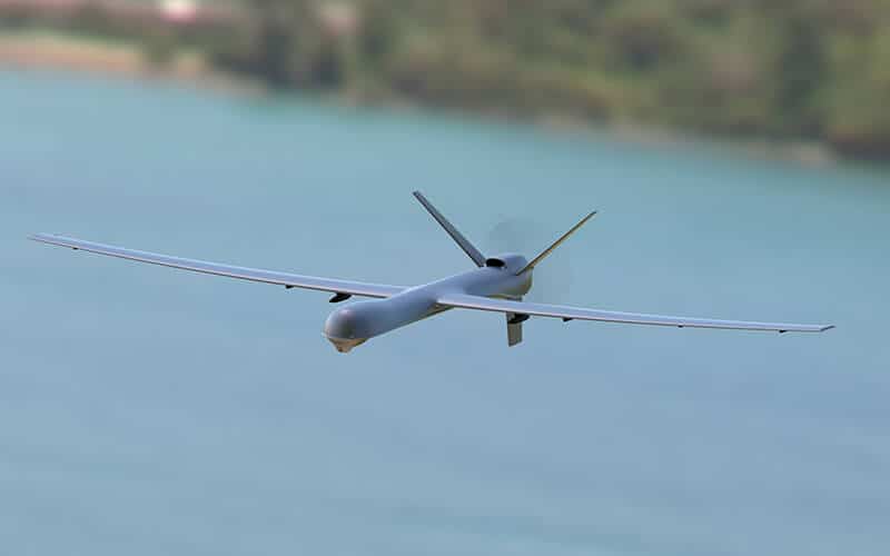
Disaster response and mitigation is an increasingly successful market for autopilot suppliers. The INS has been consistently used with Unmanned Aerial Vehicles in both GPS enabled or GPS-Denied environments. Whether they are putting out forest fires or identifying and responding to personnel in critical condition, the Veronte Autopilot (integrated Inertial Labs INS-P solution) can handle long mission profiles while carrying large payloads in GNSS-denied environments.
Navigation of Autonomous Vehicles
The Inertial Navigation System is the most robust navigation sensor on the market. Use the INS as an independent navigation sensor, or easily integrate with other sensors that the INS has been adapted for such as: LiDAR’s, Doppler Radar, Stereo Cameras, Echosounders, and many more. These useful integrations allow for a robust solution for even the most difficult-to-navigate urban environments.
GPS-Denied Navigation for Unmanned Ground Vehicles (UGV)
Inertial Labs recently released an improved navigation algorithm that increases navigational accuracy for Ground Vehicles in GNSS-Denied environments. This “Tunnel Guide” feature has been proven through trials and testing to result in a position accuracy of 0.2% over Distance Travelled (DT) in GNSS-denied environments. Data also supports that with the injection of aiding information from other onboard sensors such as an odometer, airspeed sensor, or wind speed sensor, the Inertial Navigation System can produce position accuracy as low as 0.05% over DT.
Autonomous Ground Vehicles (AGV)
Precision Agriculture, an industry on the rise for Autonomous Ground Vehicles is one of the most used cases of autonomy in this century. Recent reports show that by the year 2025, Precision Agriculture is expected to grow to become a 43.4-billion-dollar industry worldwide. For an industry that didn’t begin gaining traction until the 1990’s, it’s quite an impressive market. The INS-DL and INS-D have been a popular solution for AGVs both in the industrial and military sector for their exceptional navigation performance.
Remotely Operated Vehicles (ROV)
ROV’s are an ideal platform for the INS. These platforms have taken advantage of the advanced MEMS-based navigation features of the Inertial Labs INS. Until recently, this market was only accessible for Fiber Optic Gyroscope-based (FOG) inertial sensors. However, with improved calibration procedures and methods for precision machining being utilized between MEMS-sensitive elements, the Inertial Labs INS now can compete with FOG units in both performance and reliability.
MRU – Motion Reference Units

The Motion Reference Unit (MRU) product line was first released in 2004 when Inertial Labs MEMS-based sensor solutions began to compete in performance with traditional FOG units. Easy integration of the MRU product line for the end-user means competitive performance at no extra cost.
Factory configured to output parsed data using Inertial Labs message formats or Kongsberg/Seatex and Teledyne TSS* data formats give the user the ability to easily replace dated MRU’s with the Inertial Labs product line.
Inertial Labs developed the MRU to meet requirements for all marine and hydro-graphic applications. The MRU is a high-performance strap-down Motion Sensor that determines Pitch & Roll, Heave, Surge, Sway, Linear Accelerations, Angular Rates, Heading, Velocity, and Position for any device on which it is mounted to.
The Inertial Labs team of skilled engineers provides expertise to help users select and configure from the models available: MRU-B1, MRU-B1.1, MRU-B2, MRU-E, MRU-P and MRU-PD (with subsea models available). Our support team helps set up units for all application bases to satisfy both GNSS enabled, and GNSS-denied environments.
Use Cases for MRU
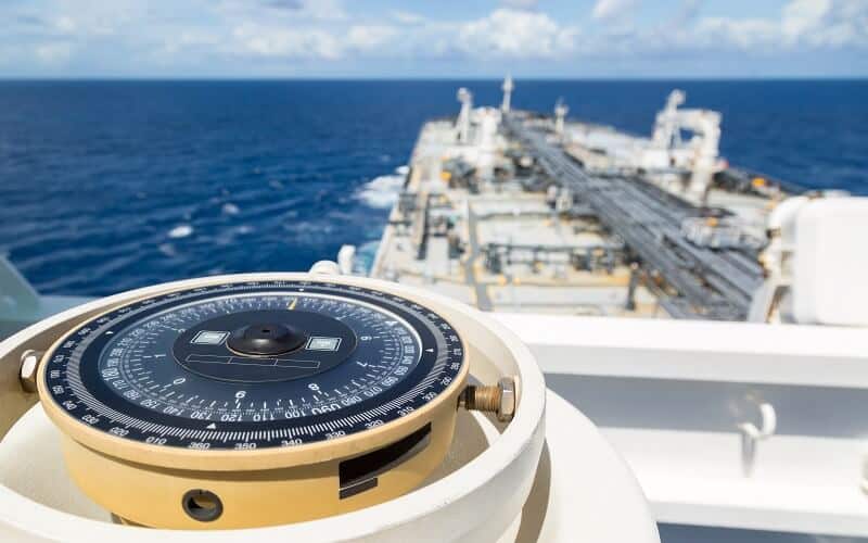
Marine Vessel Navigation
Easily paired with on-board Autopilot systems and controllers, the MRU product line features two models that are widely used for Navigation systems aboard vessels. The Professional version of the MRU (MRU-P) features a single antenna GNSS receiver used for position and velocity calculations. Similarly, the Professional, Dual Antenna MRU-PD can calculate precise position and velocity as well as heading with accuracy of 0.05 degrees (RMS), making the ideal solution for navigation on any sized marine platform.
Hydrographic and Bathymetric Surveying
Bathymetric or Hydrographic surveys are survey methods used for submarine topography that have been implemented for observation of marine landscapes and structures for several decades. The Inertial Labs MRU has the ability to be used with single beam and multibeam echo-sounders (SBES or MBES) as well as other external sensors using industry-wide accepted sentence formats (NMEA and TSS-1), where it directly passes information to internal algorithms while operating. The makes the MRU the ideal solution, especially when being used for Hydrographic and Bathymetric surveying applications.
Cargo Transfer and Loading Stabilization (ROV)
Effectively communicating motion and navigation parameters (position, velocity, heave, surge, and sway) for proper heave compensation while loading and unloading cargo and maritime equipment is an essential application used in most all shipping industries. Whether the system is fully automated, or dependent on user response, having a device that can be easily installed to replace a dated unit is where Inertial Labs stands out in comparison with competitors. Inertial Labs builds modular and custom solutions using commonly used interfaces and data formats.
Research Vessels and Buoys
Research vessels and buoys may need to run for weeks at a time without interruption of data-streams. Inertial Labs builds robust, IP67 or subsea enclosed solutions with internal data-logging abilities to record data for post-processing or real time monitoring. Default solutions can be set up to stream data wirelessly to nearby base stations where research teams can use data to interpret ocean conditions.
Helideck and Offshore Drilling Monitoring
The Motion Reference Unit is commonly used for modular captive marine vessels (MCV) and helideck monitoring (HMS); stabilizing platforms and communicating with multiple other response systems to know how to compensate for heave, surge, and sway of a vessel. Offshore oil drilling or ocean-based wind farms industries are other common markets where Inertial Labs can provide the sensor solutions required to account for motion in the ocean.
Autonomous Vessels (AUV and USV)
Autonomy has become the fastest growing industry of this century. Autonomous Underwater Vessels (AUV) or Unmanned Surface Vehicles (USV) can be used in military applications for minesweeping in the ocean, or commercial applications for underwater scanning and surveying. Inspection processes have now taken on the autonomous approach as well as the climate and environmental markets especially when navigation solutions like ones supplied by Inertial Labs are becoming increasingly more cost-effective.
Integration with ABB ACS880 Winch Drives
Inertial Labs Motion Reference Units are now fully integrated with ABB ACS880 winch drives for Offshore AHC and towing roll compensation. The ABB ACS880 winch drive and the MRU communicate over Ethernet Modbus TCP protocol with a watchdog timer for a failsafe system. Each MRU can communicate with up to two ACS880 drives in parallel for redundancy or as master/follower synchronized applications.
Performance Plots
Heave Accuracy (10 Second and 20 Second Wave Period) Dynamic Pitch and Roll Accuracy (20 Second Wave Period)MRU Certificate of Design Assessment

Representatives of the American Bureau of Shipping assessed design plans and data of all Inertial Labs MRU products. This assessment is a representation by the Bureau as to the degree of compliance the design exhibits with applicable sections of their Rules. This PDA is intended for a product to be installed on an ABS classed vessel, MODU or facility which is in existence or under contract for construction.
Certificate number 19-HS1851412-PDA
Date 10 May 2019
Heave, Pitch & Roll Dynamic Testing
Unboxing the Motion Reference Unit
Oceanic Wave Sensors

The Inertial Labs Wave Sensor (WS) product line is the latest release of tactical grade MEMS based inertial sensor solutions. In 2016 Inertial Labs responded to the research and development sectors of many biology and geographic analysis facilities for a device that is able to monitor Ocean Characteristics for Maritime Observation and Analysis. Inertial Labs has developed its Wave Sensors (WS) to meet industry wave statistics requirements and also generate spectral data as a complete set of Fourier coefficients and energies.
The Wave Sensor (WS) products are an enhanced, high-performance strap-down Wave, Direction and Motion Sensor, that determines Significant Wave Height, Max Wave Height, Wave Period, Wave Direction, Wave Energy, Directional Width, Fourier Coefficients, Mean Spread Angle, Heading, Pitch, Angular Rates, Accelerations, Magnetometer Data, Temperature, Heave, Heave Velocity and Position for any device on which it is mounted to.
The Inertial Labs team of skilled engineers provides expertise to help users select and configure from the models available: WS-E, WS-PD. Our support team helps set up units for all application bases to satisfy both GNSS enabled, and GNSS-denied environments.
Use Cases for WS
Ocean Characteristics Monitoring
The Wave Sensor meets industry wave statistics requirements and generates spectral data as a complete set of Fourier coefficients and energies. Use the WS to monitor and record or communicate using RF in real time to a base station Wave Parameters and Ocean Characteristics such as: Significant Wave Height, Max Wave Height, Wave Period, Wave Direction, Wave Energy, Directional Width, Fourier Coefficients, Mean Spread Angle and much more.
Dynamic Positioning on Research Buoy’s and Vessels
Mount using the IP67 or Subsea enclosure (rated to a minimum of 200 meters) on research buoy’s and vessels (autonomous and manually operated). Communicate in real time using Radio Frequencies (RF) or take advantage of the WS-PD and pair with an Real Time Kinematic (RTK) Base Station from Inertial Labs for RTK communications. Ideal for Dynamic Positioning (DP-1/2/3) applications requiring but not limited to all common GNSS constellations (GPS, GLONASS, GALILEO, BeiDou, QZSS, NAViC, AltBOC, SBAS, DGPS, RTK).
University Oceanology Studies
Partnering with colleges and universities around the globe Inertial Labs offers the Wave Sensor and a development kit bundle which includes the sensor, all cables and the Graphical User Interface; all with a educational discount. Many schools and research facilities have taken advantage of these bundles including: Texas A&M, Tel Aviv University, Penn State University, Nagaoka University of Technology, Virginia Tech, Quebec University and Seoul National University.