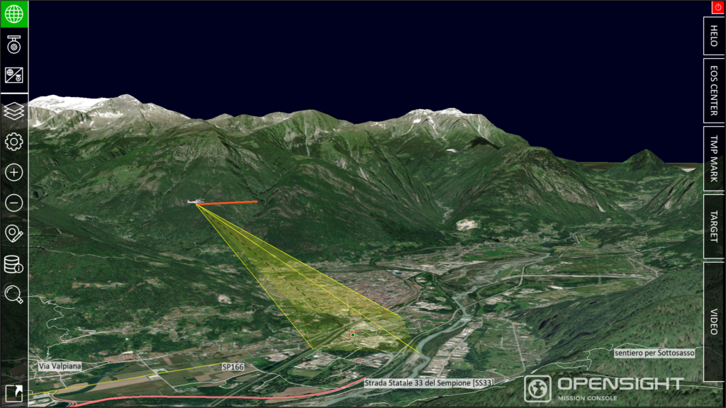
FlySight’s cutting-edge OPENSIGHT geospatial analytical solutions provide accurate and timely situational awareness for airborne missions, enhancing operational processes and ensuring mission success.
Geospatial data is essential for the operational success of both military and civilian users. It forms the backbone of many operations, ranging from pinpointing the exact location of a military target to providing topographical insights for Search and Rescue (SAR) missions.
Geospatial analytics involves the process of gathering, analyzing, and visualizing data tied to specific geographic locations. This data can then be applied in real-time to align with the operation’s objectives.
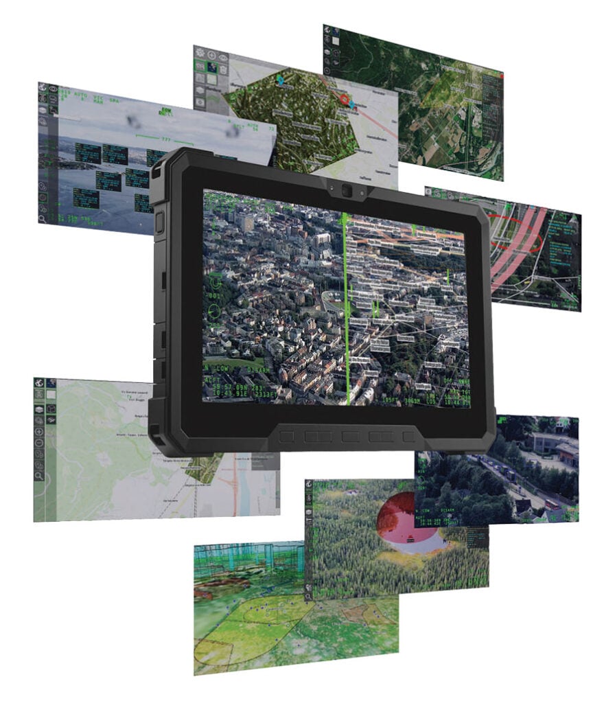
Leveraging geospatial analytics, FlySight’s OPENSIGHT systems support mission planning, execution, and debriefing, enabling seamless coordination between air and ground teams.
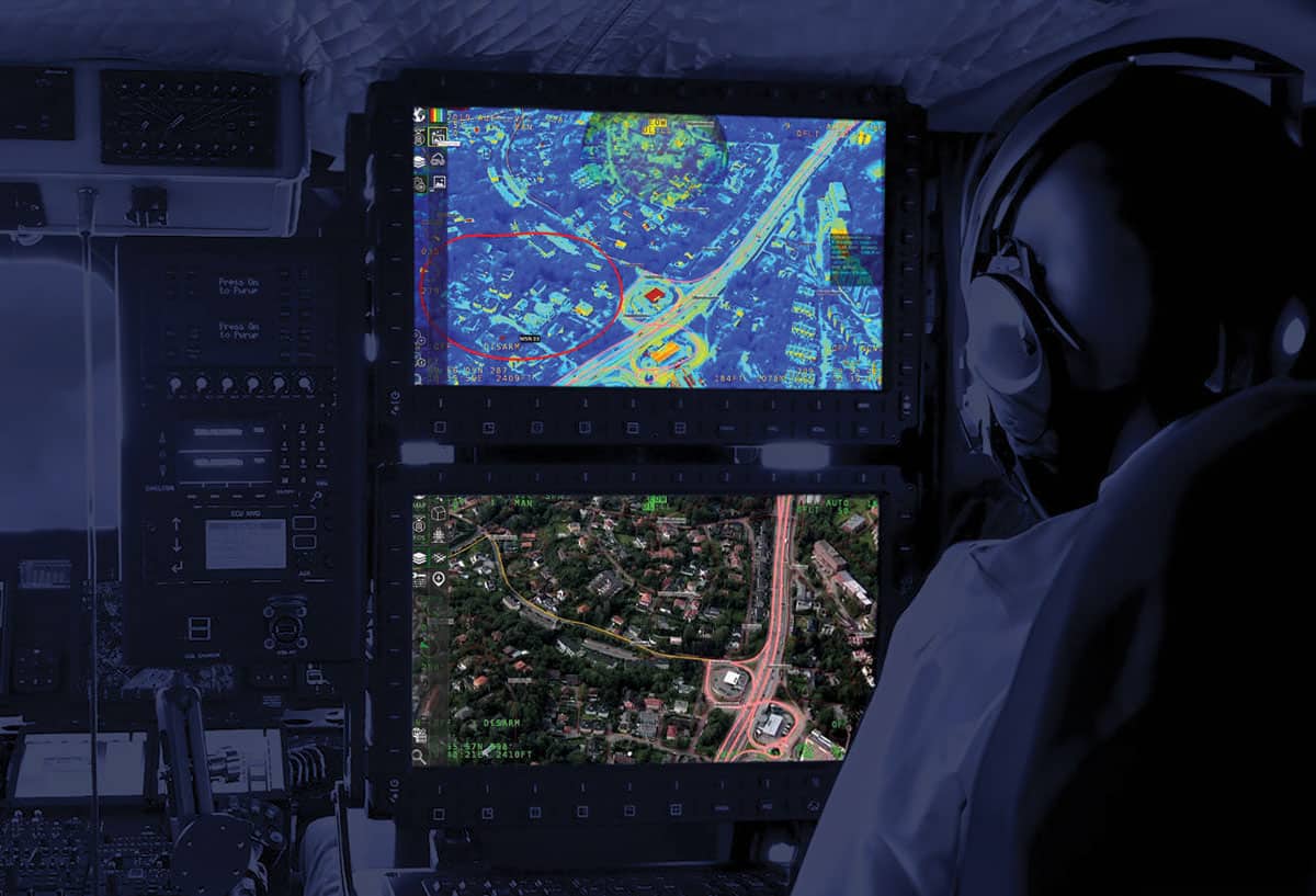
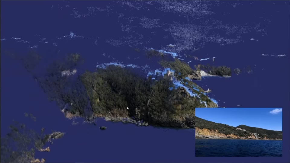
Using 3D Enhanced Reality, operators can gain instant access to multi-layered data, improving situational awareness and understanding of mission parameters, even in dynamic environments.
Understanding Geospatial Analytics
Geospatial data can be acquired through multiple methods. At its core, geospatial data analytics begins with coordinates on the Earth’s surface, which are relatively straightforward to obtain.
Once collected, supplementary data can be added to provide a more comprehensive and nuanced view of the situation. Latitude and longitude coordinates alone offer only a location, without additional context such as whether the area is urban or rural or the structures present. To address this, additional data must be integrated, enhancing the observer’s understanding of the location’s features, temporal details, and multiple data layers.
Both human operators and AI systems analyze this information to extract pertinent insights, which are then shared with field operators.
Key Types of Geospatial Data
Geospatial data consists of several crucial components. These data sets can be combined and analyzed to produce a detailed, multi-layered perspective:
- Geographic information: This foundational layer provides geographical coordinates from sources such as maps, charts, and graphical representations.
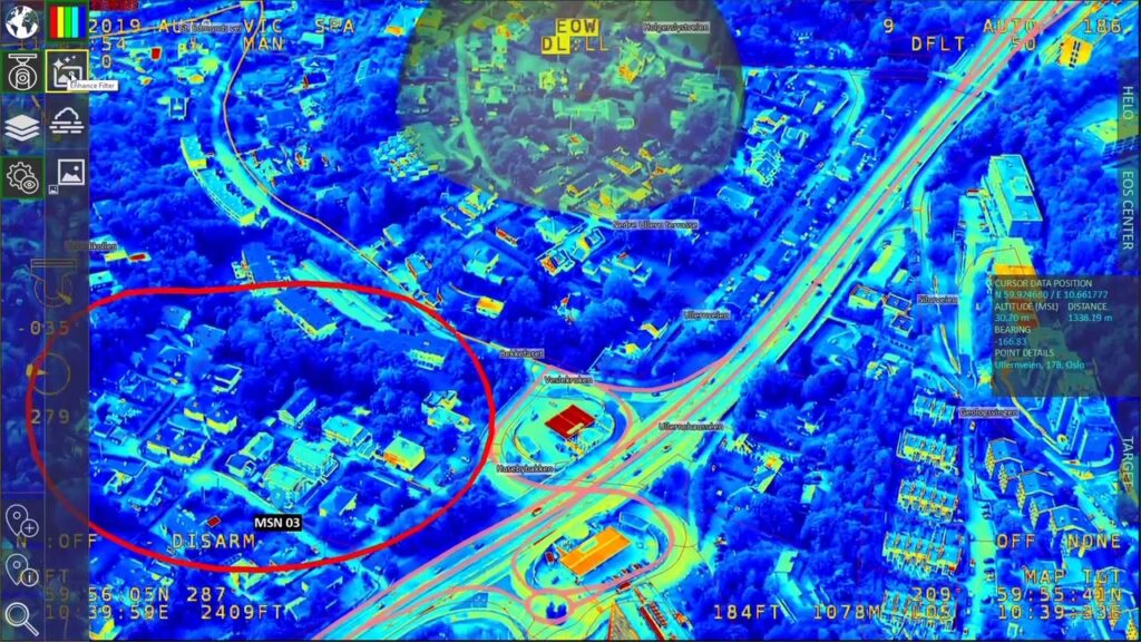
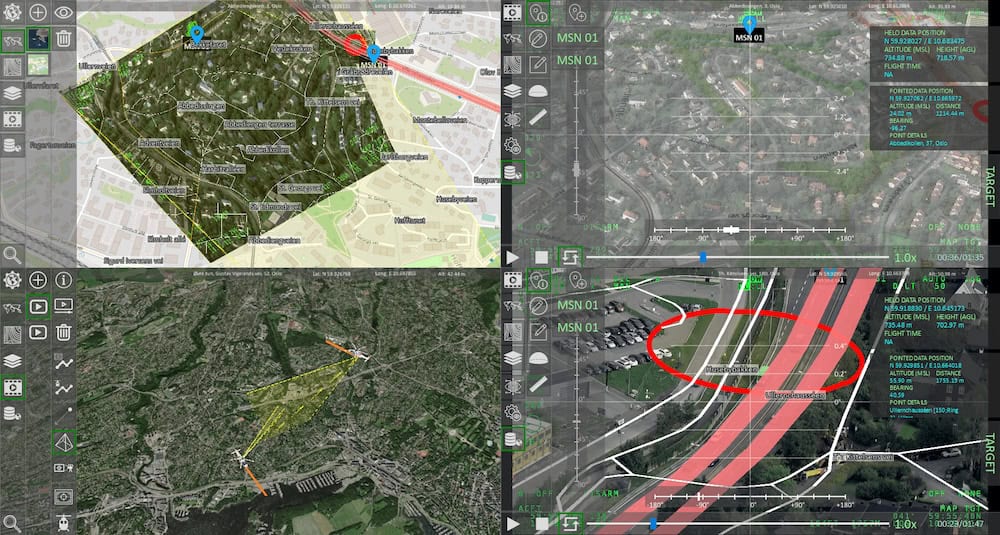
- Visual records: This category includes real-time visual observations and pre-existing information from tools like FlySight’s OPENSIGHT Consoles, which utilize various multi-spectral cameras and data-collection technologies.
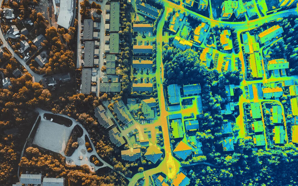
- Geospatial data: This encompasses information about objects and features at specific locations. Such data may represent transient events, like earthquakes or wildfires, or dynamic elements, such as moving vehicles.
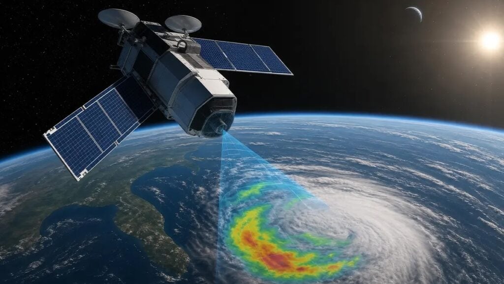
Geospatial data is sourced from platforms like satellite imagery, weather reports, and multi-spectral visual data, including infrared imagery. This information can be further augmented with existing data sets, such as mobile phone records and census details, and layered onto topographical maps to create a richer, more detailed operational picture.
Advantages of Geospatial Data Analysis
The volume of geospatial data that can be gathered is immense. This creates challenges in processing, but advancements in AI enable rapid data analysis and storage. AI systems can process vast amounts of data, relay insights to users, and store them in the Cloud, ensuring worldwide access.
Storage systems for geospatial data analysis can be configured as closed systems for secure, sensitive data or open systems for general information like weather and geographic data.
Raw data no longer requires analysis solely by trained professionals. AI systems can process data efficiently, removing irrelevant information and adhering to predefined parameters to extract relevant details. Human operators then review the refined data and relay it to the end user, often aerial platform operators such as helicopter crews.
Geospatial data analysis offers additional benefits, such as:
- Providing advance warnings of potential issues or changes, particularly useful in disaster relief or predicting the spread of infectious diseases.
- Offering insights into the effectiveness of analytical systems, enabling organizations to refine processes for improved efficiency.
Applications of Geospatial Data
Geospatial data can be continuously updated to deliver the most current and relevant information to end users. This is critical in scenarios like SAR, where natural disasters may have altered topographical landscapes. It also plays a key role in surveillance operations involving moving targets and dynamic situations like crowd management.
In military contexts, particularly airborne operations in hostile environments, geospatial data is indispensable. Real-time analysis and dissemination of the latest information are crucial for field operators.
SAR teams rely on real-time geospatial data to locate targets in challenging conditions. For instance, SAR helicopter units require precise weather data to ensure the safety of both their targets and their crews.
Similarly, firefighting teams combatting forest wildfires depend on geospatial data to target hotspots. This includes topographical data, maps, and multi-spectral imagery, especially infrared.
Law enforcement agencies can use geospatial data analysis for surveillance and crowd control. Urban surveillance benefits from layered data, such as facial and license plate recognition, maps, and graphs, overlaid on topographical maps to reveal detailed insights.
Utilities services also leverage geospatial data to pinpoint underground infrastructure, assess surrounding landscapes, and coordinate emergency responses in case of failures or natural disasters.