

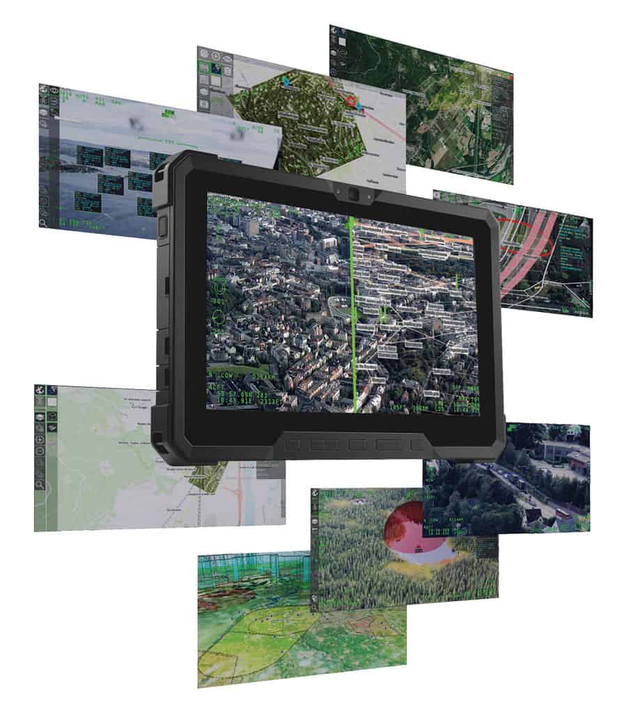
OPENSIGHT is a multi-domain PED (Processing, Exploitation, and Dissemination) solution that utilizes real-time geospatial and environmental information from a diverse range of sensors and sources to provide up-to-the-minute situational awareness that supports the warfighter during mission-critical operations.
The state-of-the-art software uses sophisticated AI and data fusion algorithms to extract critical insights and contextualize the data, layering the resulting information onto intuitive 3D map displays and AR (augmented reality) views to create a COP (common operating picture) that significantly enhances situational awareness and decision-making.
The multi-platform solution can be deployed on a wide variety of workstation, desktop and mobile systems. Featuring a fully open and modular software architecture, it is fully customizable and extendable to suit even the most unique of requirements. Designed in full accordance with STANAG guidelines, it can be easily integrated into any existing C4ISR/ISTAR systems.
Developers can take full advantage of the OPENSIGHT framework via a comprehensive Software Development Kit (SDK) that enables the creation of highly customized mission planning, execution and debriefing solutions tailored to specific defense and security operations and theaters. The SDK provides a wide range of STANAG, MIL-STD and ARINC interoperability features, allowing it to directly interface with NATO systems and providing interoperability with third-party solutions.
OPENSIGHT’s functionality can be further enhanced through a number of plugins and modules, including:
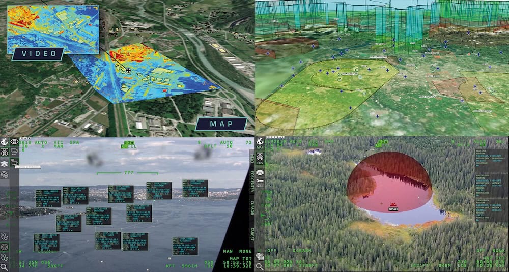
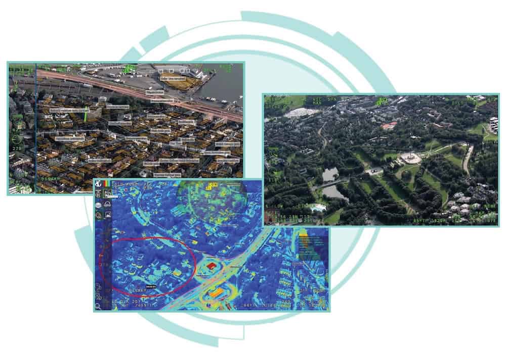
OPENSIGHT Enhanced Reality – provides seamless integration of augmented and mixed reality capabilities into existing legacy systems. Multiple map charts can be overlaid onto video feeds and populated with custom points and objects of interest, such as real-time representations of streets, buildings, cars, and other specific targets.
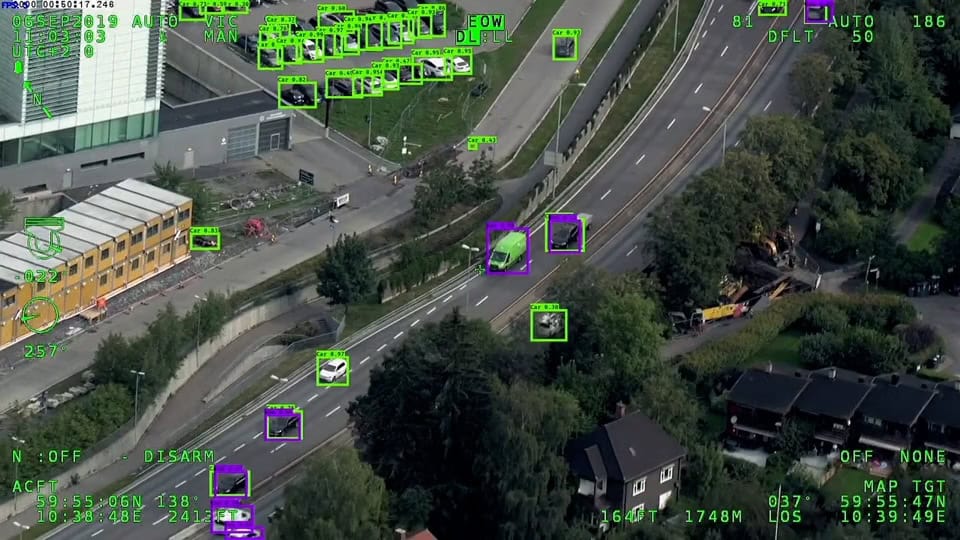
OPENSIGHT ATR (Automatic Target Recognition) – uses advanced AI inference capabilities to deliver automatic target detection, classification and identification in highly complex environments. Images and video feeds can be processed from any EO sensors, and the software can output video annotations as well as mapped georeferenced detections.


