verifiedThis business has been claimed by FlySight and verified by DA.Verified companies work with us to ensure we display the most up-to-date and comprehensive product information, articles and other material to help you choose the right solution for your requirements.
Geospatial Software Solutions for Mission-Critical Military, Defense & Security Operations
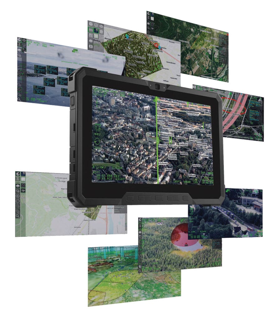
FlySight is a leading developer of geospatial software solutions for mission-critical military, defense and security operations. Our products provide real-time support for airborne, naval and underwater operators, enabling more effective decision-making and improved mission outcomes.
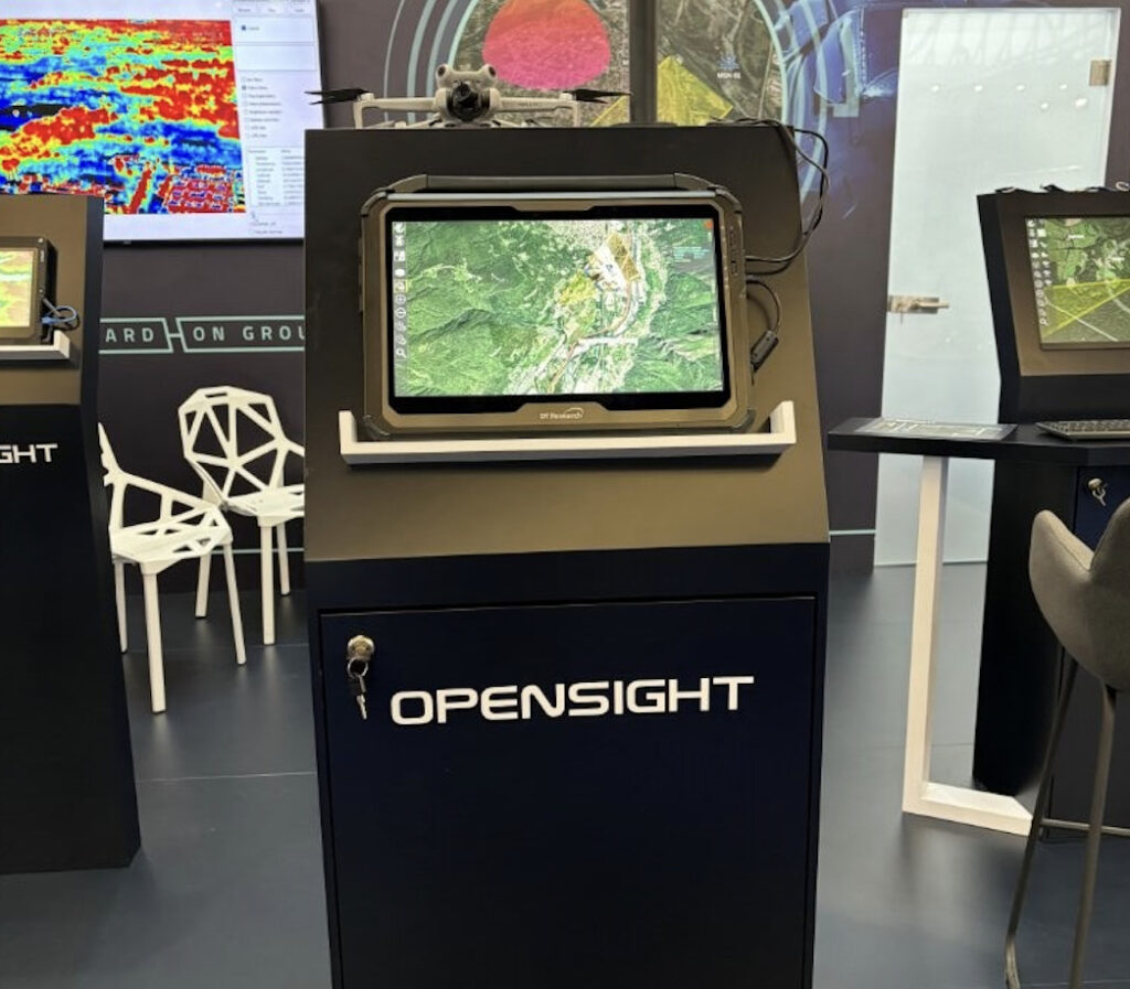
FlySight’s OPENSIGHT, an innovative AI and deep learning-powered software with Mixed Reality capabilities, adheres to STANAG and OGC standards and has been widely adopted by military agencies and defense primes. It has been selected as a partner for integration with various advanced systems, including Avionic Platforms, Mobile Phone Identification, Geolocation and Communication sensors, and High-performance Mission Computers, showcasing its versatility and effectiveness in multiple defense and security applications.
Cutting-edge multi-domain PED software for enhanced situational awareness
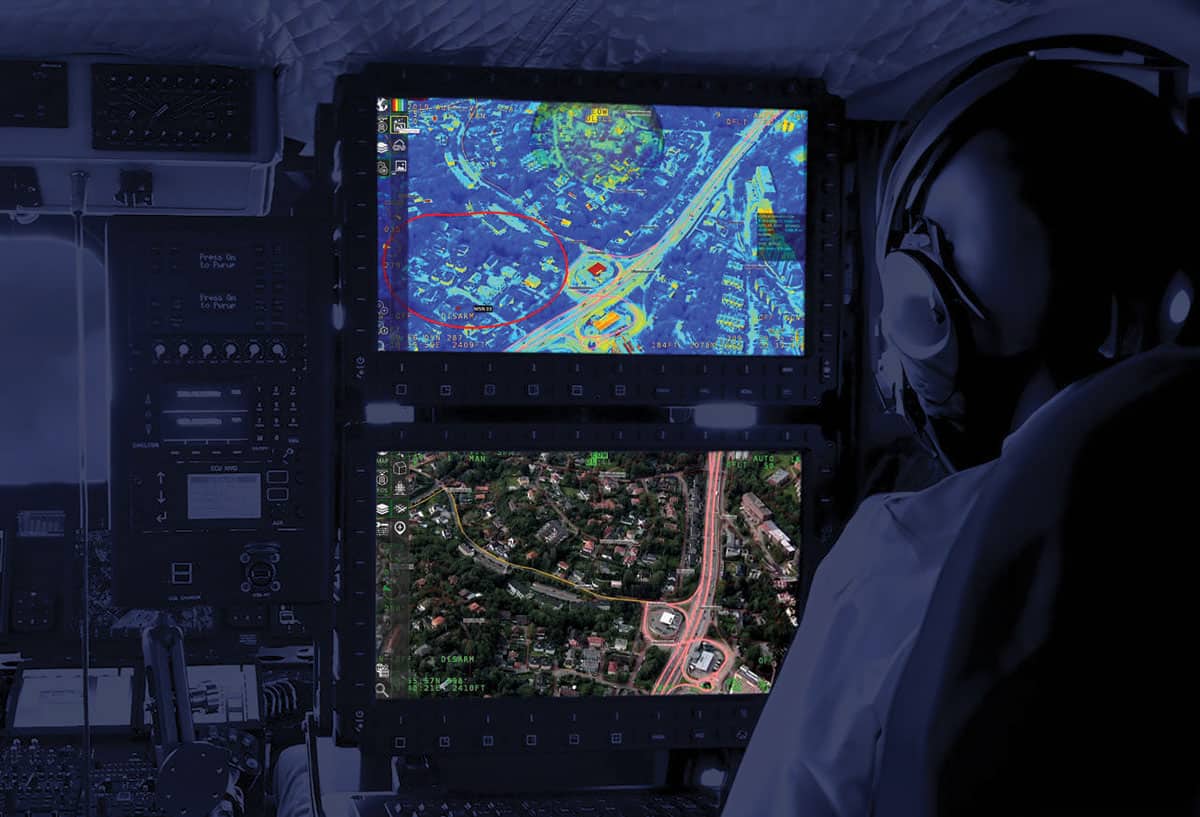
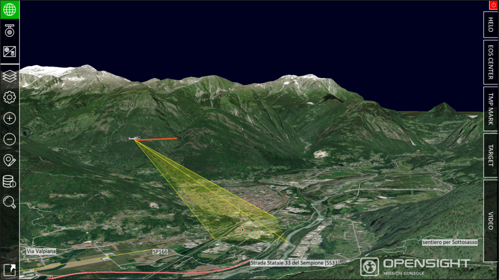
OPENSIGHT is a multi-domain PED (Processing, Exploitation, and Dissemination) solution that utilizes real-world geospatial and environmental information within a synthetic environment to provide up-to-the-minute situational awareness that supports the warfighter during mission-critical operations.
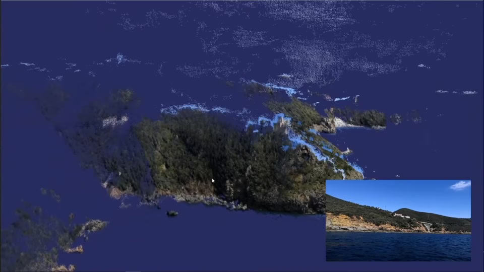
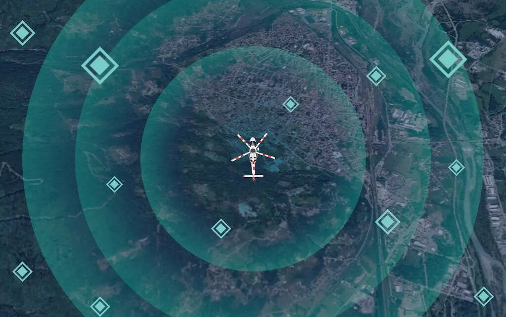
The system takes in real-time raw data from a diverse range of sensors such as EO/IR, radar, LiDAR and sonar, and utilizes sophisticated AI and data fusion algorithms to extract valuable insights and contextualize the data. Information is layered onto intuitive 3D map displays and AR (augmented reality) views, creating a COP (common operating picture) and allowing operators to make vital and informed decisions with the utmost in confidence.
The multi-platform solution is hardware- and OS-agnostic, and can be deployed on workstation, desktop and mobile systems. It has been designed as a fully open and modular software architecture, and is fully customizable and extendable to suit even the most unique of requirements. OPENSIGHT has been designed in full accordance with STANAG guidelines, and can be easily integrated into any existing C4ISR/ISTAR systems.
The OPENSIGHT Software Development Kit allows developers to create highly customized mission planning, execution and debriefing solutions tailored to specific defense and security operations and theaters. User-created modules can be exported as stand-alone applications or libraries for deployment on existing hardware, enabling new and advanced capabilities without the cost of acquiring completely new systems.
The SDK offers a wide range of built-in STANAG, MIL-STD and ARINC interoperability features, allowing it to directly interface with NATO systems and providing interoperability with third-party solutions and existing geo-databases. It provides a comprehensive array of functions for creating advanced mapping and visualization tools, including:
3D real-time visualization and manipulation
Raster and vector geospatial management compliant with OGC standards
Augmented reality tools
Video viewer and recorder
Mini-map within the video feed and split-screen
OPENSIGHT Plugins
To respond to your specific mission, some of the available add-ons:
NATO STANAG 4607 – Ground Target Tracking Enhancement
Additional module specifically designed to decode Ground Moving Target Indicator (GMTI) data
NATO STANAG 7023 – NATO Imagery Decoder
This purpose-built module is designed to decipher and process NATO-standard imagery
NATO STANAG 4586 – Unmanned Aerial Systems Integration
This tailored module is crafted to enable OPENSIGHT’s seamless interaction with Unmanned Aerial Vehicles (UAVs), ensuring robust communication and control
NDI – High-Performance Video Processing
This specialized module is designing for encoding high-definition, real-time video streams with metadata.
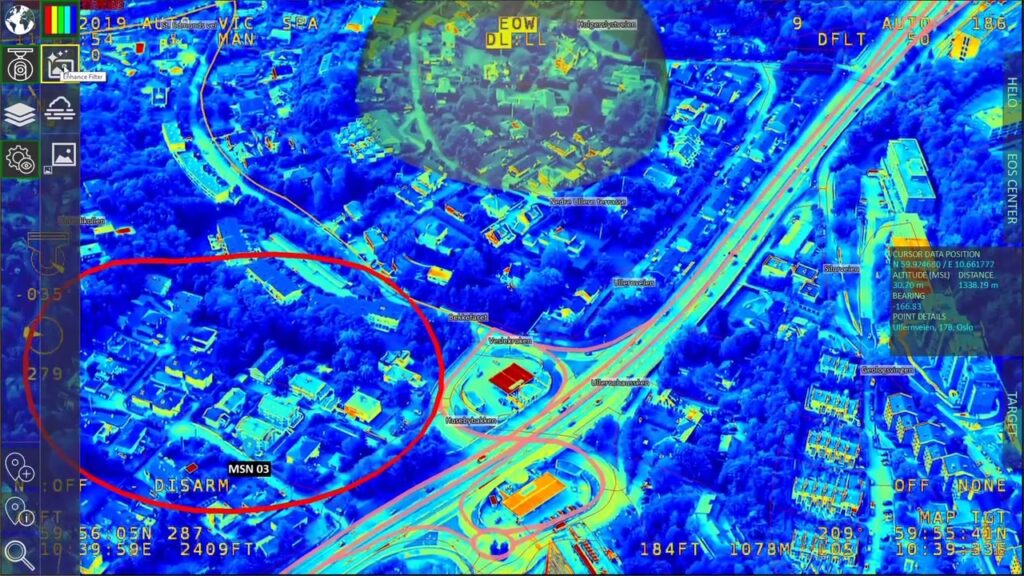
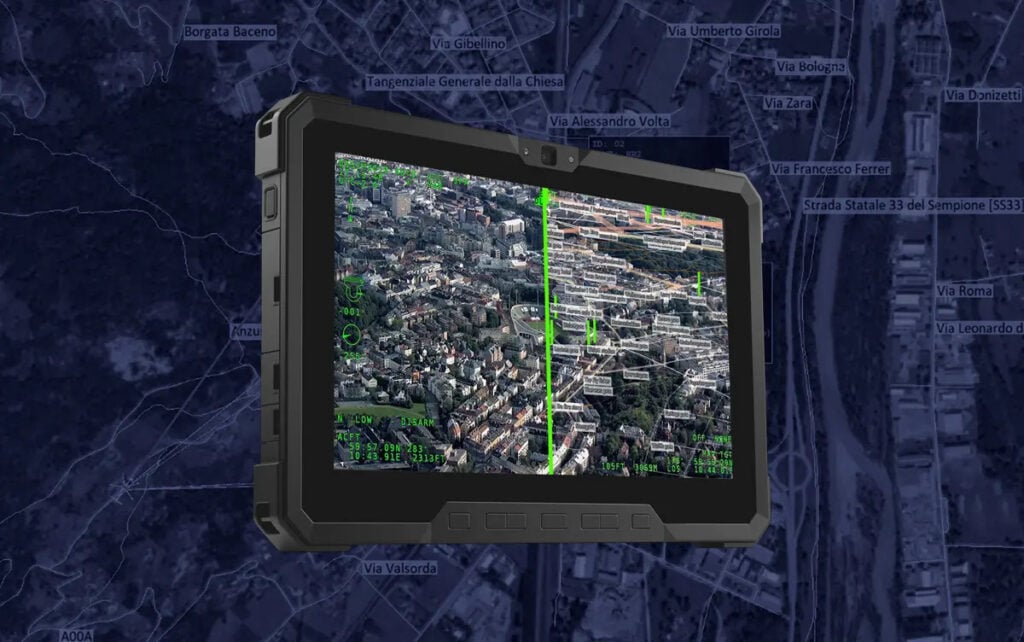
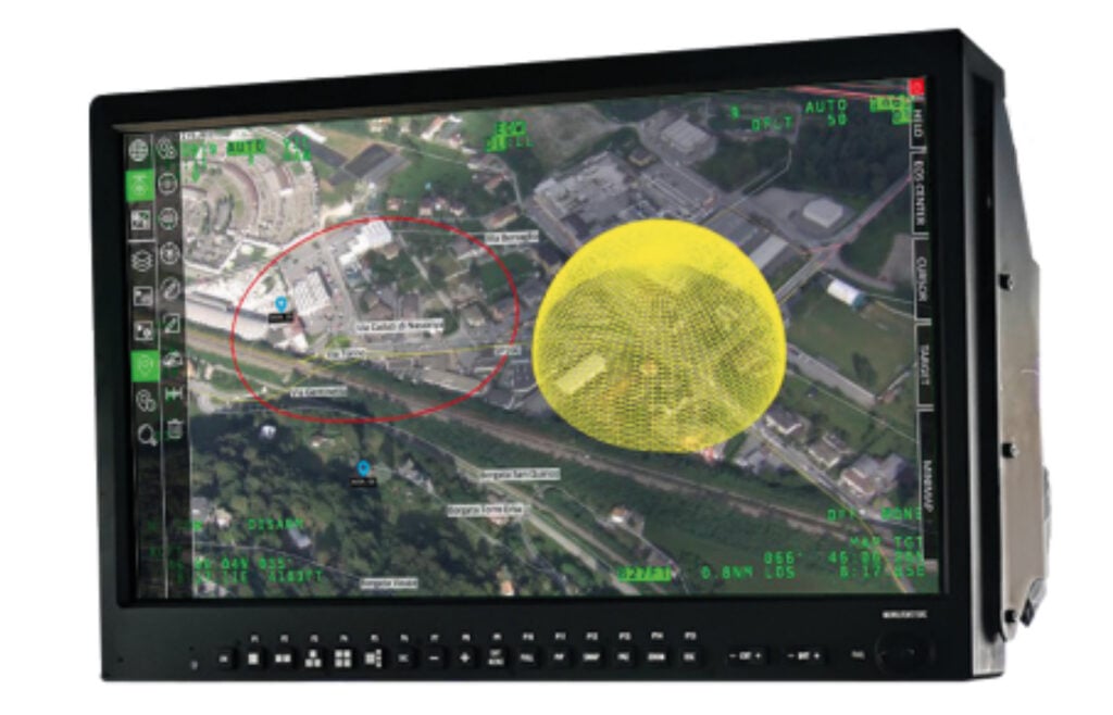
The OPENSIGHT Enhanced Reality system allows seamless integration of augmented and mixed reality capabilities into existing legacy systems, providing advanced video processing, decoding, encoding, and re-streaming with a real-time display.Users can define multiple map charts that can then be overlaid onto video feeds with adjustable opacity. The software allows you to define custom points and objects of interest, such as real-time representations of streets, buildings, cars, and other specific targets, and activate and deactivate them as required.
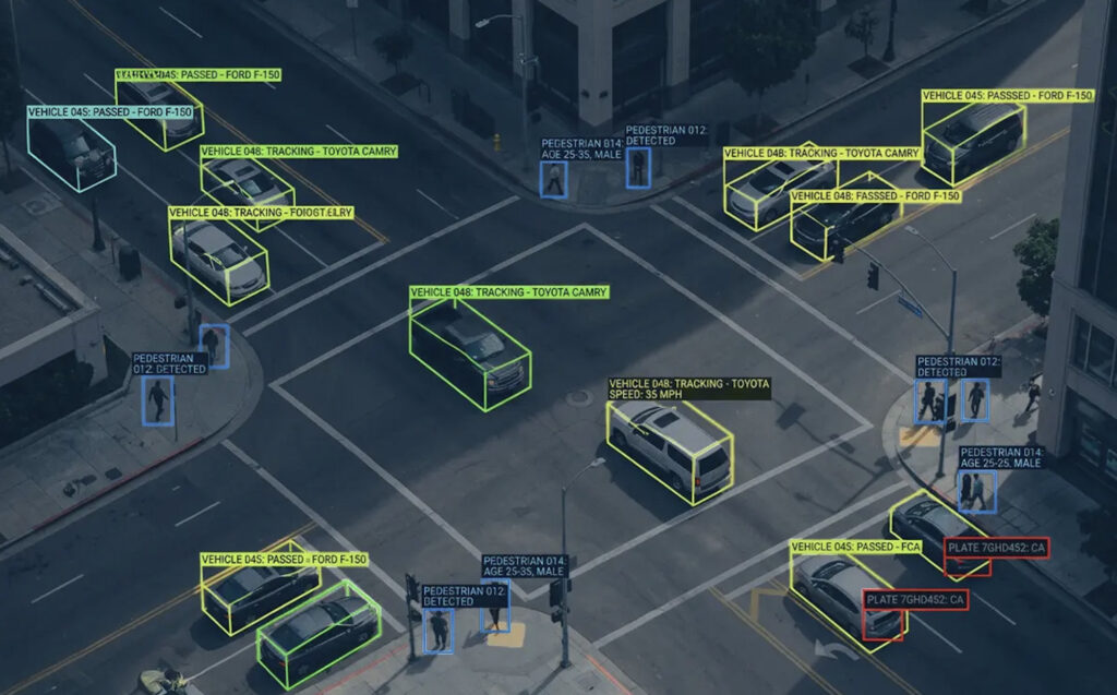
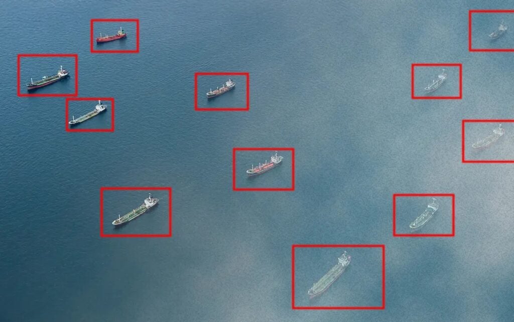
The Automatic Target Recognition (ATR) system is a powerful OPENSIGHT addon designed to maximize targeting performance for military and defense surveillance operations. Offered as a standalone capability or as an integrated component of the OPENSIGHT Mission Console, it uses advanced AI inference capabilities based on the TensorRT engine to deliver automatic target detection, classification and identification even in highly complex environments.
The software provides a training environment for processing of image and video from all EO sensors, delivering accurate and reliable results for enhanced situational awareness. It can output annotated video feeds as well as mapped georeferenced detections.
OPENSIGHT ATR has been integrated with Aitech’s rugged A179 Lightning AI supercomputer to create a complete off-the-shelf low-SWAP solution for aerial surveillance.
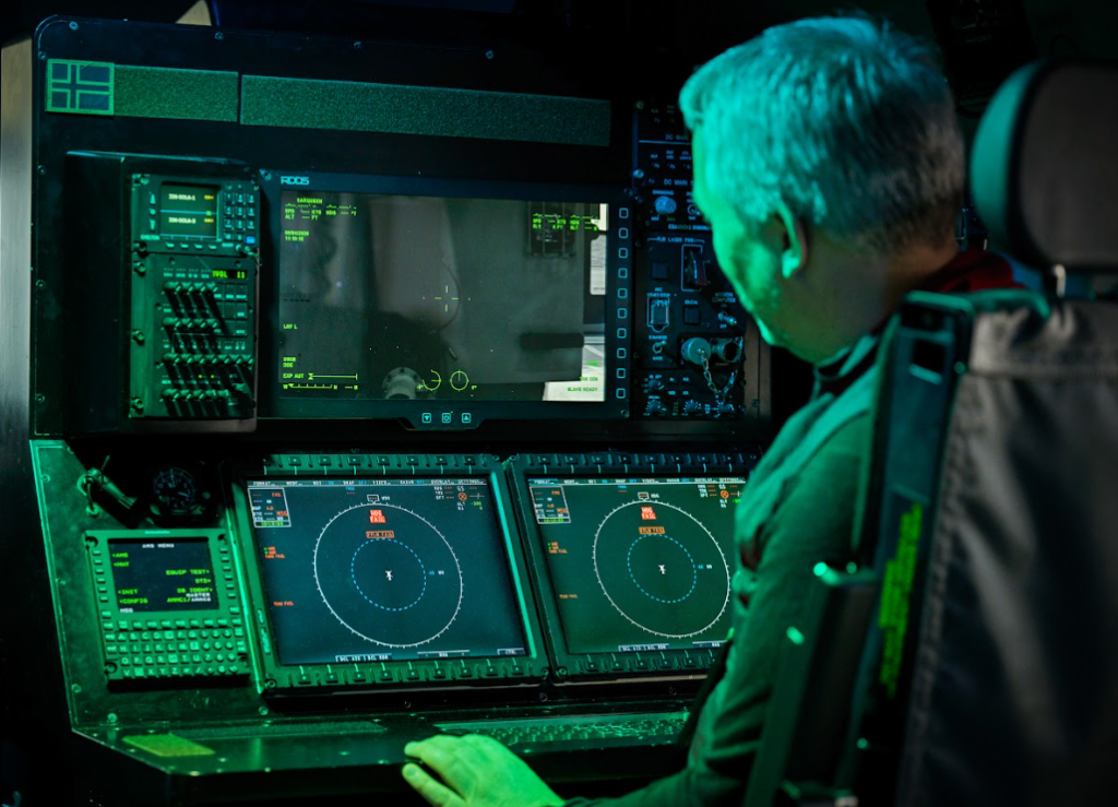
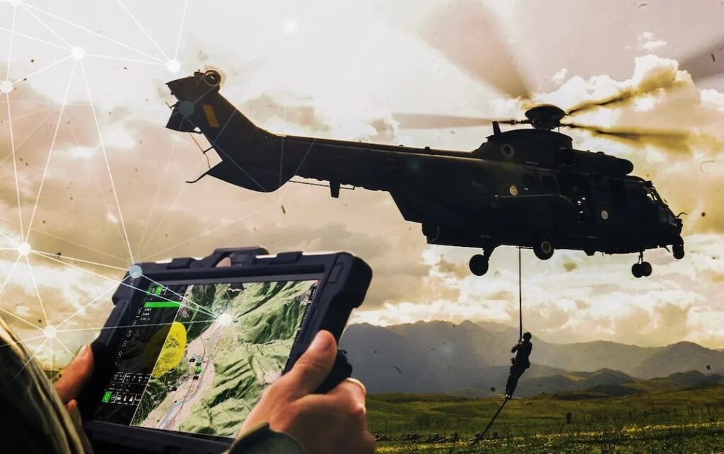
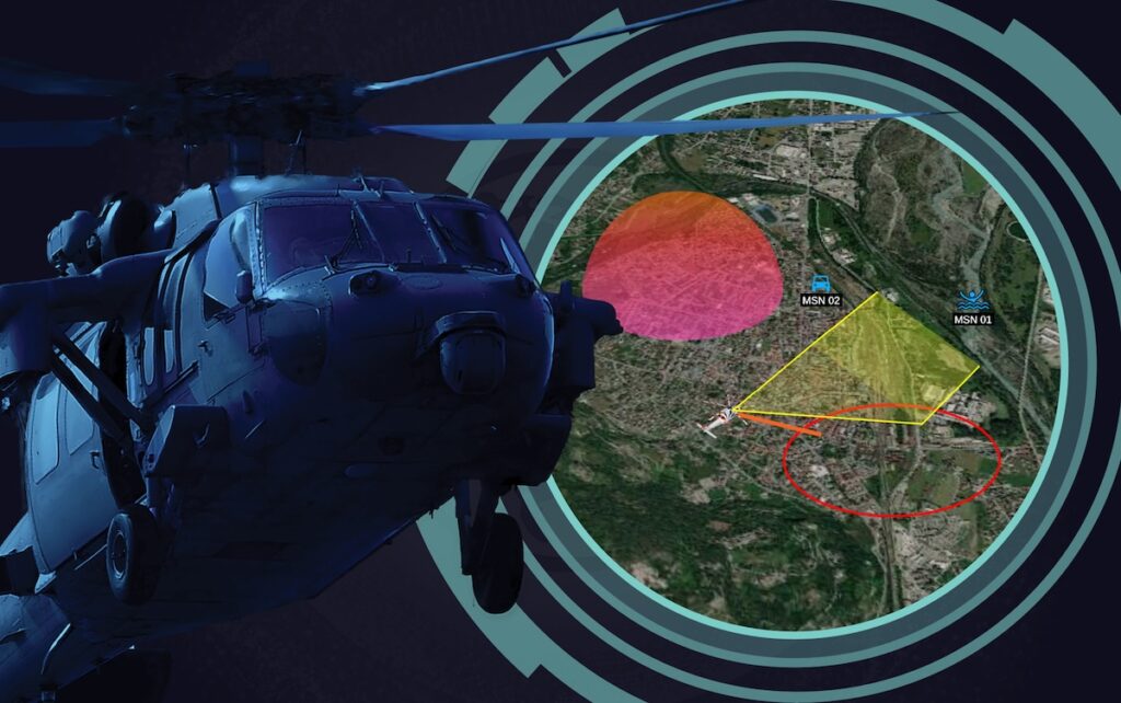
OPENSIGHT Mission Console is specifically designed to provide airborne payload operators with advanced AI-powered augmented reality capabilities, overlaying all information directly on the video for ease of use and reduced cognitive burden.
Capable of handling multiple high-resolution video feeds, Mission Console improves geospatial situational awareness by superimposing multiple synthetic information layers. The versatile solution can be customized to display any desired proprietary data, and offers automatic target detection and classification of both airborne and maritime threats.
This turnkey solution includes the following key capabilities:
Moving map
3D rendering engine
Geodatabase for direct and inverse geocoding
Enhanced reality
Extensive advanced support for avionic chart
Image processing features
Mission Console OPEN CODE
The real-time Augmented Reality engine with Artificial Intelligence support for airborne payload operators is even faster to integrate into any mission system thanks to the OPEN CODE provided to OPENSIGHT Software Development Kit users.
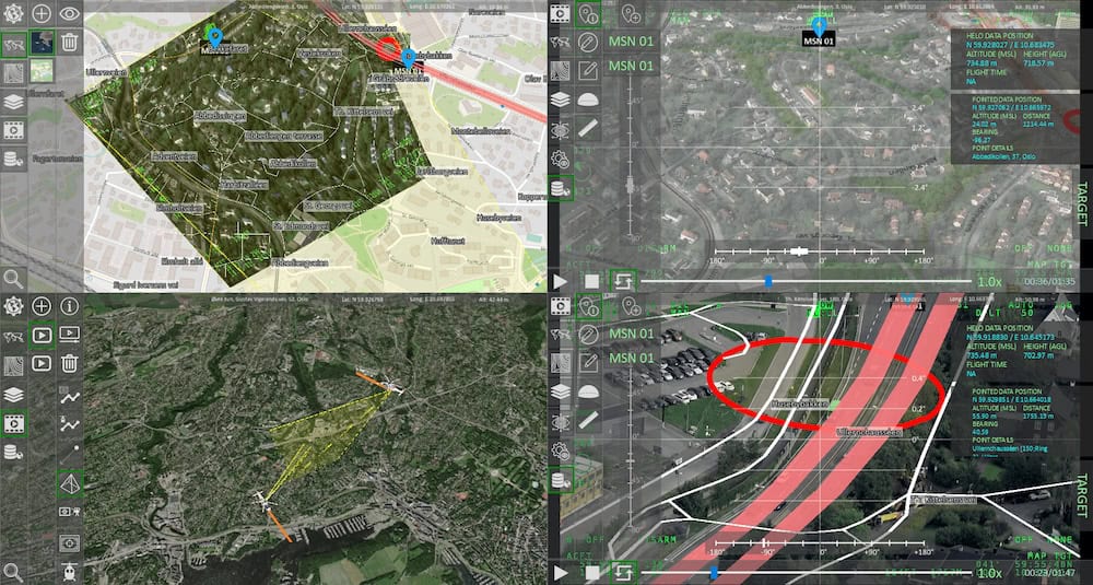
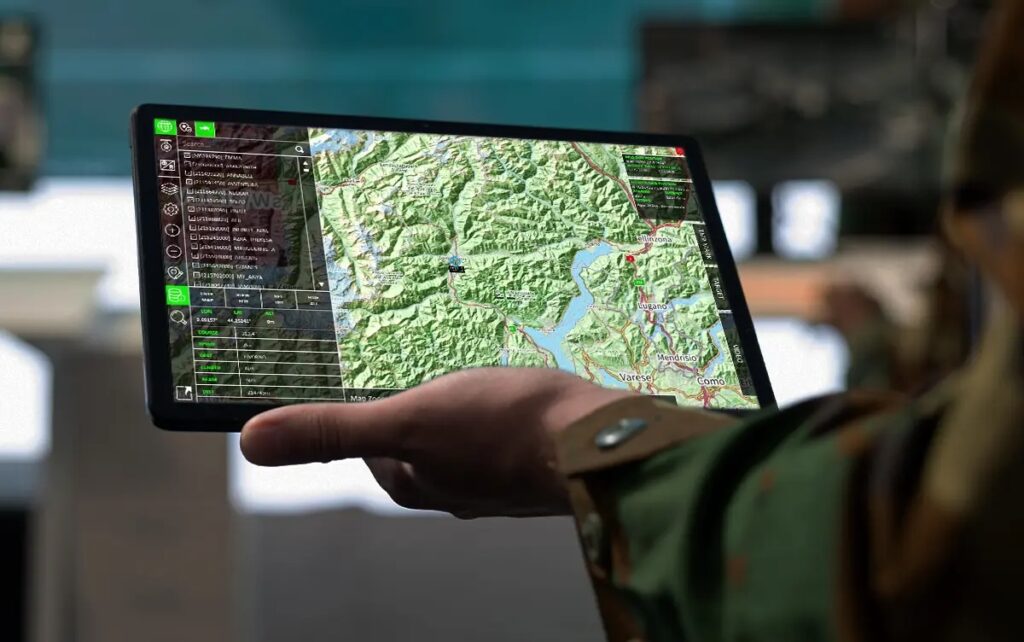
OPENSIGHT Analyst Console
OPENSIGHT Analyst Console is an all-in-one management solution for airborne missions, providing planning, real-time supervision, and debriefing capabilities in a single software package. It can ingest multiple high-resolution STANAG4609 streams, allowing a single operator to supervise and coordinate several missions simultaneously.
The powerful software also makes it easy to search recorded data, tag and record events, extract geo-referenced images and video clips, and create post-mission reports.
OPENSIGHT Underwater Optronic Mast Console
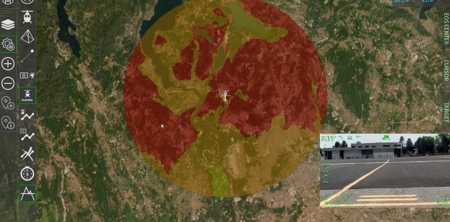
The Underwater Optronic Mast Console provides submarine crews with a turnkey solution for electro-optical data processing, utilizing AI-powered image and video processing and augmented reality to reduce operator workload and deliver enhanced situational awareness.
The system can fuse the information provided by a range of different sensors such as visible, LWIR, SWIR, and IR, and also includes automatic target detection and classification capabilities specialized for both airborne and maritime threats.
FlySight has highlighted how the integration of Artificial Intelligence (AI) is transforming video surveillance from passive recording into an active, real-time decision-making system across civilian, law enforcement, and military sectors
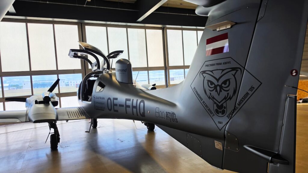
Diamond Aircraft and FlySight integrated the OPENSIGHT Mission Console onboard a Diamond Aircraft platform, supporting real-time visualization, sensor integration, and geospatial intelligence during flight operations
FlySight’s upcoming INTELCAST Workshop in Brussels will examine how artificial intelligence can enhance meteorological, oceanographic and space weather data for military planning, training and defence operations
FlySight has partnered with Rapid Imaging Solutions to distribute and promote its OPENSIGHT mission management and situational awareness software suite across the U.S. law enforcement, security, and airborne mission operations market
New onboard sensor processing and automated target recognition technologies undergo successful helicopter integration trials to improve missing person detection in complex environments
FlySight specialists Giacomo Fontanelli & Francesco Carli lead live demonstrations of the OPENSIGHT platform’s AI-enabled 3D rendering and sensor integration for airborne payload operators
As part of a newly launched EDF-funded consortium, FlySight will lead the extraction of structural information from multi-source sensor data to enhance situational awareness in dense urban environments
FlySight’s OPENSIGHT Mission Console is being integrated within MOSA architecture to demonstrate enhanced interoperability, modularity, and real-time situational awareness for mission and avionics systems
FlySight and DRASS are showcasing their Integrated Submarine System at SEAFUTURE 2025, demonstrating scalable, secure technologies for underwater operations, with FlySight highlighting advanced simulation, data integration, and operator-focused capabilities at Booth A10
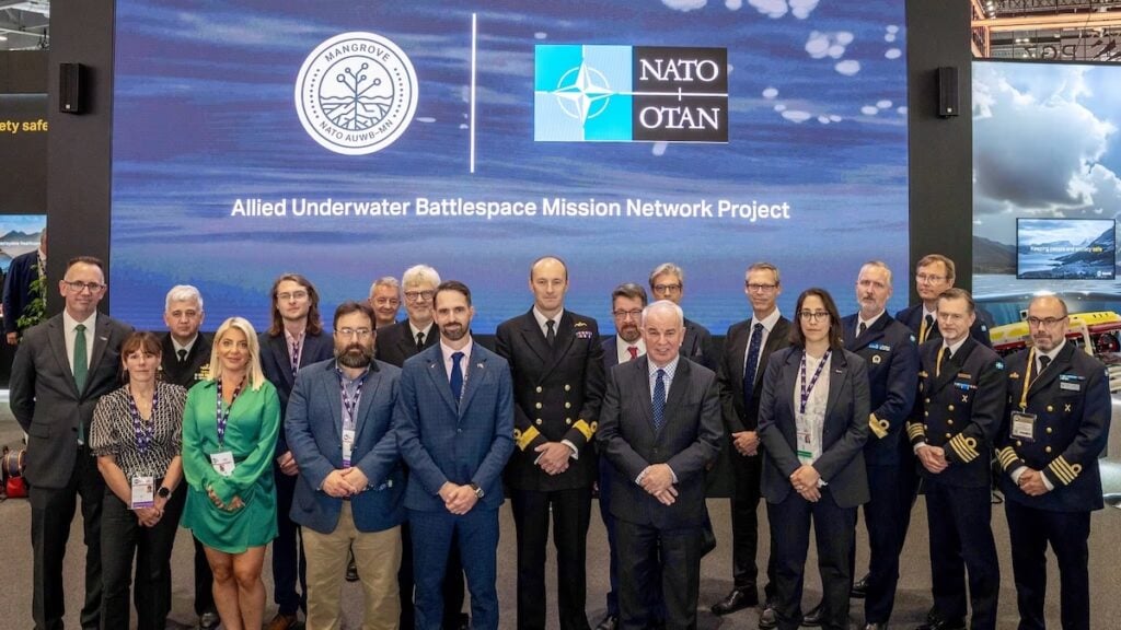
FlySight has joined the Saab-led MANGROVE consortium, supporting NATO’s new Allied Underwater Battlespace Mission Network project to enhance interoperability and strengthen maritime security among allied militaries
FlySight has launched MAP CREATOR, a new tool in the OPENSIGHT ecosystem designed to accelerate the preparation of geospatial datasets for real-time 3D rendering in defense and mission-critical applications
FlySight discusses the impact of tactical edge computing technologies in military environments, enabling real-time data processing, improving operational efficiency, and supporting autonomous systems
FlySight examines recent advancements in ISR and ISTR technologies, highlighting software-driven capabilities, system integration, and the evolving role of AI
FlySight explains how its OPENSIGHT Enhanced Reality System delivers layered AR visualization, real-time video enhancements, and customizable overlays for airborne, tactical, and training operations
FlySight’s OPENSIGHT system is advancing Augmented Reality (AR) with solutions that enhance aviation, law enforcement, and training through real-time data integration and improved situational awareness
FlySight's OPENSIGHT Mission Console software system and H-Tech's MFAR mission computer aim to enhancing operational efficiency and situational awareness for militaries and civilians
FlySight outlines how geo-remote sensing is leading the evolution of technology in redefining aerial operations and offering unparalleled insight into mission-specific threats
FlySight’s latest case study delves into how defense, law enforcement, and search and rescue operations can be enhanced through Automatic Target Recognition systems
FlySight makes its Aero India debut, showcasing the OPENSIGHT Mission Console and live Automatic Target Recognition, demonstrating cutting-edge AI-driven target detection and mission management capabilities
FlySight outlines how the OPENSIGHT Aircraft Mission System addresses operator challenges in military aviation, enhancing mission effectiveness with AI and Enhanced Reality technology
FlySight will integrate advanced situational awareness technology into Canada's AW101/CH-149 SAR helicopter fleet modernization program, enhancing mission capabilities through AR-enabled visual systems
Deployed on Abaco’s MAGIC1A rugged line replaceable unit system, FlySight’s OpenSight multi-platform Processing, Exploitation and Dissemination system provides a new approach to ISR operations
Jun 21, 2021
Regional Offices & Locations
FlySight Headquarters
Italy
Via A. Lampredi 45, Livorno
+39 0586 505016 ContactWebsite
India Representative
India
SureTech International. B 5/6 Safdarjung Enclave, Africa Avenue, New Delhi 110029
+91 (011) 4165 3421 ContactWebsite
Malaysia Representative
Malaysia
Sovereign Strategic. Unit No. E-3A-3, Encorp Strans Garden Office, No.12, Jalan PJU 5/1, 47810 Kota Damansara, Petaling Jaya, Selangor
+603 61424877 ContactWebsite
Advancing Defense Capability Through Strategic Collaboration
Defense Advancement works with major OEMs to foster collaboration and increase engagement with SMEs, to accelerate innovation and drive defense capabilities forward.