Find Military Laser Rangefinder manufacturers and suppliers of Laser Range Finding (LRF) technology for military helmets, binoculars, firearms, vehicles and drones
If you design, build or supply Laser Rangefinders / Laser Range Finding (LRF), create a profile to showcase your capabilities and connect with visitors who have an active requirement for your solutions.
Laser rangefinders (LRFs) calculate distances to targets or objects of interest and are used by armed forces for a variety of applications.
Common LRF Technologies
The two most common technologies utilized in military laser rangefinders are time-of-flight, where the time taken for a laser pulse to be reflected by the target and received again at source is measured, and phase shift measurement which uses reflected pulses at multiple frequencies.
Laser pulses may often be coded to reduce the effects of jamming, which can occur when another source of laser light is shone onto the rangefinder’s detector.
Military Laser Rangefinders
Military laser range finders may be handheld (typically in binocular form), or mounted on tripods, helmets, firearms or directly onto vehicles. They are commonly used to enhance the targeting accuracy of infantry weapons as well as bombs, missiles, and artillery and armoured vehicle weapons. Military-grade laser rangefinders will typically need a rugged design that can survive in extremely harsh environments such as deserts, jungles and mountainous regions.
Military LRF Applications
Laser rangefinders are used by infantry, special forces, aircraft and vehicles to undertake reconnaissance and target finding and to improve situational awareness. They may have both daytime and night vision modes and may also include thermal imaging capabilities. Some systems incorporate a magnetic compass and inclinometer, providing azimuth and elevation readings in addition to distance.
Laser Range Finding for Drones & Robotics
Laser rangefinders are also used for a variety of UAV (unmanned aerial vehicle) applications. They are often incorporated into drone camera gimbals for targeting and ISR (intelligence, surveillance and reconnaissance), and some can be integrated with GNSS/GPS and GIS data capture for precision mapping. They can also be used as UAV flight and navigation aids, providing altitude measurement for precision takeoff and landing, terrain-following and distance-keeping.
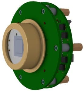
Analog Modules, Inc.’s AMI Series rangefinder receivers and processors deliver highly accurate, corrected range data for defense laser rangefinding and targeting systems
Analog Modules, Inc. is set to highlight its next-generation 744DP Laser Spot Tracker Module and advanced laser electronics solutions at XPONENTIAL 2026 / MDEX in Detroit
Analog Modules Inc. provides laser range receiver and spot tracker modules informed by operational feedback, supporting integration into defense platforms operating under challenging environmental and countermeasure conditions
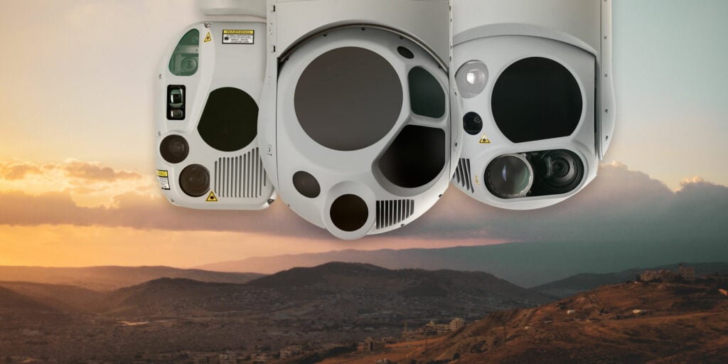
ARK Electronics has introduced the ARK DIST SR and ARK DIST MR, USA-manufactured distance sensor modules for mission-critical UAS, robotics, and defense applications, offering compact, low-SWaP designs with versatile connectivity
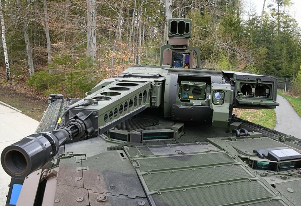
HENSOLDT is set to provide its PERI-RTWL turret-independent stabilized main optics, and its WAO turret-bound stabilized fire control optronics, for the PUMA infantry fighting vehicle (IFV)
The high energy laser manufacturing capability will enable the development and delivery of laser sources suitable for directed energy applications
Apr 06, 2023
Advancing Defense Capability Through Strategic Collaboration
Defense Advancement works with major OEMs to foster collaboration and increase engagement with SMEs, to accelerate innovation and drive defense capabilities forward.