ISR Simulation Training
Discover cutting-edge solutions from leading global suppliers
Military simulation and training software developer Bohemia Interactive Simulations (BISim) has launched the latest releases of its flagship products, VBS4 and VBS Blue IG.
BISim’s VBS4 is a whole-earth virtual and constructive simulation and simulation host which fully supports a range of military-specific training and mission rehearsal use cases.
VBS Blue IG is a high-performance, CIGI-compliant, 3D whole-earth image generator designed to support the full spectrum of land, sea, air and space use cases.
VBS4 and VBS Blue IG 22.2 include many new features, ease-of-use upgrades, and performance enhancements, including:

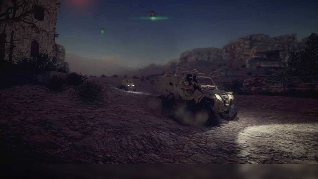
- VBS4 Map – VBS4’s 2D map has undergone a major overhaul and now supports layers. Users can select layers from online sources (e.g., Google Maps, Bing, OSM, etc.) as well as local MBTile formats which can be generated using open source tools. Layers can be ordered, styled, and blended to create a custom mapping for each training scenario. A new map export feature has also been added, which allows users to create printable maps in any style, and scale with additional features.

- Volumetric Clouds – The latest VBS4 release adds new volumetric clouds, which give true 3D volume to the clouds, improved lighting, and cast shadows onto the underlying terrain. Cloud density can be changed, and, in upcoming releases, BISim envisions users having further detailed control over the types of clouds in the scene.

- 3D Grass – VBS4 and VBS Blue IG 22.2 include global, regionally-specific 3D grass and other ground cover vegetation. The 3D ground cover enhances the realism of all scenes. ‘Fair fight’ has been factored into the implementation, so entities (e.g., soldiers) lying in the grass are hidden from other entities even at extreme distances. Users moving through grass also flatten the grass as they move.

- Global Buildings and Roads – With VBS4 and VBS Blue IG 22.2, users can access updated, optionally downloadable, world buildings and road data. This updated data is built from the most recent OpenStreetMap source, which improves building and road coverage everywhere in the world. The new world building and road data also provides enhanced procedural building textures for a more natural appearance in every location.

- VBS World Server (VWS) Data Management – The data management panel is now available within the VWS, allowing full control of terrain insets being served to connected VBS4 and VBS Blue IG clients. Administrators can toggle the display of terrain insets as well as modify layers within insets at runtime.

- Developer Suite – The VBS Developer Suite allows users to quickly import new 3D content into VBS4 and VBS Blue IG. No proprietary 3D modeling tools are required, and content can be imported from many standard formats. The latest software releases include a new Template Configuration Assembler in the Developer Suite. This new tool automatically generates content configuration files (config.cpp & model.cfg) from a simple user interface. This allows vehicles to be imported and configured without the need to manually modify text-based configurations. This, combined with the Mesh Compatibility Checker, greatly simplifies and accelerates importing models into VBS4 and VBS Blue IG.
- Radar Simulation – VBS4 22.2 adds new radar simulation and radio and radar signal detection to VBS4. These are the first of several upcoming electronic warfare capability enhancements. The radar simulation allows administrators to apply radar sensor capability to any entity or vehicle in the battlespace. The radar can be configured with performance characteristics including range, detection altitudes, refresh rate, and effectiveness, allowing the emulation of many radar types. The administrator view (not visible to trainees) shows the radar volume and indicates objects that have been detected in both 2D and 3D. The trainee using the radar is presented with a generic sensor user interface which allows them to track the entities and data such as speed, heading and altitude.

VBS Blue IG 22.2 includes the graphical enhancements described above (volumetric clouds, 3D grass), plus:
- Object clamping, allowing entities to be attached to 3D content (e.g., bridges)
- Improvements to the appearance and performance of vehicle tracks
- Particle effect improvements for vehicle dust trails and helicopter rotor wash
- New missile trails which can enhance the appearance and performance of all missiles in any scene
- Improved video streaming capability allowing streaming of VBS Blue IG channels to web pages
The new releases are now available to download via the Customer Portal.