

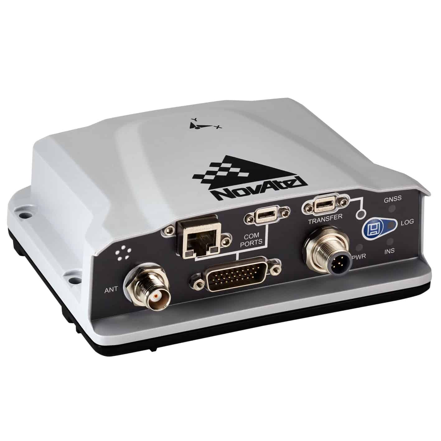
The PwrPak7 is a compact enclosure that delivers scalable Global Navigation Satellite System (GNSS) with internal storage and INS options.
The PwrPak7 is capable of tracking all present and upcoming GNSS constellations and satellite signals. It also offers optional integrated INS support for continuous position, velocity and attitude through short periods of GNSS outage.
With its powerful GNSS engine, onboard NTRIP v1.0 and v2.0 client and server support, 16 GB of internal storage and enhanced connection options including serial, USB, CAN and Ethernet, the PwrPak7 is ideal for base station or rover applications.
Features- Multi-frequency, multi-constellation GNSS receivers offering flexible positioning options and ease of integration
- GLIDE® smoothing algorithm
- RAIM for increased GNSS pseudorange integrity
- RTK and ALIGN firmware options
- Intelligent interference detection and mitigation
- SPAN® INS functionality
- Next generation NovAtel GNSS technology
- Supports current and future GNSS signals
- Multiple communication interfaces for easy integration and installation
- Compact, lightweight and easy to integrate
System Type: Enclosed
General Info
Length (mm): 145
Width/Diameter (mm): 147
Height (mm): 53
Weight (g): 500
Typical Power Consumption (w): 1.8
Signal Tracking
GPS: L1 C/A, L1C, L2C, L2P, L5
GLONASS: L1 C/A, L2C, L2P, L3, L5
BeiDou: B1l, B1C, B2a, B2b, B2l, B3l
Galileo: E1, E5 AltBOC, E5a, E5b, E6
NavIC: L5
SBAS:
QZSS: L1 C/A, L1C, L2C, L5, L6
L-Band:
Number of Com Ports
RS-232: 1
RS-232/RS-422 Selectable: 2
IMU: 1
USB Device: 1
USB Host: 1
Ethernet: 1
CAN Bus: 1
Event Input: 3
Event Output: 3
Performance
Accuracy: (RMS)
Single Point L1: 1.5 m
Single Point L1/L2: 1.2 m
SBAS: 0.6 m
DGPS (code): 0.4 m
TerraStar-C PRO: 2.5 cm
TerraStar-L: 40 cm
RTK : 1 cm + 1 ppm


