Navigation Doppler LiDAR is a resilient navigation technology that measures platform motion relative to the ground using coherent Doppler or FMCW techniques. It provides velocity vectors, drift correction data, and external motion references for UAVs, crewed aircraft, autonomous ground vehicles, and defense platforms operating where GNSS, vision, or radar may be degraded.
This page showcases leading navigation Doppler LiDAR manufacturers with solutions for UAV navigation, convoy operations, targeting support, persistent surveillance, material replenishment, and emergency services aviation.
If you design, build or supply Navigation Doppler LiDAR, create a profile to showcase your capabilities and connect with visitors who have an active requirement for your solutions.
Precision navigation for military and commercial vehicles in GNSS-denied & contested environments
Precision navigation for military and commercial vehicles in GNSS-denied & contested environments
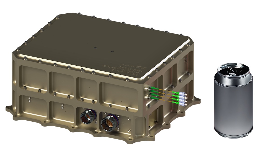
... is an assured navigation solution for military land vehicles that uses advanced DopplerLiDAR... ...S and inertial navigation sensor architectures. It provides RS-422, CAN and Ethernet interfaces, and...
Overview of Navigation Doppler LiDAR for Autonomous Navigation in Contested Environments
Overview by
Joseph Macey
Updated:
Introduction to Navigation Doppler LiDAR
Navigation Doppler LiDAR (NDL) measures platform motion relative to the ground using coherent Doppler or frequency modulated continuous wave techniques. It provides velocity vectors, drift, and motion data to maintain accurate positioning in GNSS-denied or degraded environments.
Used across defense, avionics, emergency response, and unmanned systems, NDL supports resilient navigation where GNSS, radar, or vision systems fall short. Integrated with inertial systems and autonomy software, it improves vehicle localization, reduces drift, and enhances route control for reliable mission execution in complex operating conditions.
Applications of Navigation Doppler LiDAR
Psionic SurePath Ground-V Navigation Solution with Navigation Doppler LiDAR Technology
UAV Navigation
UAV navigation systems use Doppler LiDAR to maintain accurate motion awareness during low-altitude flight, autonomous landing, and operations in GNSS-denied conditions. This is particularly valuable for drone navigation systems supporting reconnaissance, resupply, and operations in contested airspace.
Convoy Operations
Ground forces and security teams can use LiDAR motion sensor data to support convoy operations across off-road terrain where map alignment and satellite coverage may be unreliable. The technology improves vehicle localization and helps reduce cumulative navigation error during long route segments.
Targeting Support
Navigation quality directly affects target acquisition and precision targeting performance. A Doppler LiDAR system can improve the positional confidence of platforms that cue electro-optical, infrared, or weapon guidance systems for targeting and close air support.
Persistent Surveillance
Persistent surveillance systems depend on accurate platform motion compensation to maintain track quality and sensor pointing. Navigation Doppler LiDAR can support situational awareness platforms by providing stable velocity measurements for surveillance and targeting workflows.
Material Replenishment
Material replenishment systems for unmanned aircraft and autonomous ground vehicles need dependable navigation during approach, landing, and delivery. NDL technologies can help reduce drift and improve control during last-mile logistics in complex terrain or degraded visibility.
Emergency Services Aviation
Emergency aviation crews operating rotorcraft or fixed-wing platforms often face smoke, dust, low light, and disrupted communications. A LiDAR positioning system can enhance flight stability, localization, and safer navigation during rescue, medical evacuation, and disaster response missions.
Types of Navigation Doppler LiDAR Systems
Coherent Doppler LiDAR Systems
Coherent Doppler LiDAR systems measure motion by detecting Doppler frequency shifts in returned laser energy. They are widely associated with high-sensitivity velocity measurement and are well-suited to demanding avionics and defense environments.
Frequency Modulated Continuous Wave LiDAR
Frequency-modulated continuous-wave LiDAR architectures support simultaneous range and velocity extraction in a compact design. These systems are often considered where size, weight, and power constraints matter for UAVs and airborne payload integration.
Scanning Doppler LiDAR
Scanning Doppler LiDAR systems sample motion across multiple directions or sectors to build a more complete understanding of movement and surrounding geometry. This can benefit object detection, terrain-relative awareness, and dynamic landing or route assessment.
Direct Detection Doppler LiDAR
Direct-detection Doppler LiDAR approaches can be used for specialized velocity-sensing applications where system architecture or mission constraints differ from those of coherent designs. Selection depends on performance requirements, platform type, and environmental operating conditions.
Navigation Doppler LiDAR Compared With Other Navigation Approaches
Compared with GNSS-based navigation, navigation Doppler LiDAR offers resilience in denied or jammed environments but usually works best in combination with inertial and mission systems rather than as a complete standalone replacement. Its value is strongest where the continuity of motion sensing matters more than broad-area absolute positioning.
Compared with inertial navigation alone, NDL can reduce drift by providing external motion references. This makes it useful for long-duration missions, low-altitude flight, and autonomous vehicle navigation systems that cannot tolerate increasing position uncertainty.
Compared with camera-based visual navigation, LiDAR-based object detection and motion sensing can be more dependable in some low-texture or low-light scenarios, although performance still depends on atmospheric and surface conditions. Compared with radar, LiDAR may provide high precision motion data in a smaller package, though environmental tolerance and range behavior differ by design.
Relevant Standards & Compliance Considerations
Navigation Doppler LiDAR systems may need to meet different qualification expectations depending on whether they are used on defense, aerospace, emergency services, or dual-use platforms.
MIL-STD-810: Commonly relevant for environmental engineering and ruggedization, including vibration, shock, temperature, humidity, sand, dust, and other harsh operating conditions.
MIL-STD-461: May apply where electromagnetic interference and electromagnetic compatibility must be controlled for integration with mission systems, avionics, communications equipment, or onboard electronics.
STANAG requirements: Influence interoperability, testing, data handling, and platform integration expectations for NATO-aligned programs, depending on the host vehicle and mission role.
RTCA DO-160: Often relevant in airborne environments for environmental conditions and test procedures for avionics and aircraft-mounted equipment.
Airworthiness and safety frameworks: May apply to emergency services, aviation, and civil-military dual-use platforms according to the requirements of the operating authority.
Software and cybersecurity assurance: Typically required where navigation Doppler LiDAR is integrated with autonomy software, mission computers, flight control systems, or networked vehicle architectures.
These standards help ensure that navigation Doppler LiDAR equipment can be integrated reliably into mission systems operating in demanding or safety-critical environments.
Key Selection Criteria for Defense & Avionics Programs
Program teams typically evaluate navigation Doppler LiDAR against a defined operational profile. Important considerations include velocity accuracy, update rate, range performance, size, weight, and power, as well as environmental robustness against dust, rain, fog, vibration, and shock.
Integration requirements are equally important. Buyers often assess interfaces for flight computers, mission computers, inertial systems, autonomy stacks, and vehicle localization software, as well as calibration requirements and platform stabilization performance. For UAV navigation and crewed avionics, certification pathways, electromagnetic compatibility, and airworthiness-related integration constraints may also shape procurement decisions.
Emerging Trends in Navigation Doppler LiDAR
As resilient navigation becomes increasingly important, navigation Doppler LiDAR is gaining attention as a practical technology for improving localization when conventional navigation aids are degraded or unavailable.
GPS-denied navigation: Growing demand for reliable navigation in denied, degraded, or contested environments is increasing interest in Doppler LiDAR as an external velocity reference.
INS integration: Navigation Doppler LiDAR is increasingly being paired with inertial navigation systems to reduce drift and improve localization when GNSS is unavailable or unreliable.
Compact sensor design: Smaller, ruggedized systems are supporting wider adoption on UAVs, autonomous ground vehicles, and other size-constrained platforms.
Multi-sensor navigation: Future systems are likely to combine Doppler LiDAR with INS, GNSS, radar, optical sensors, and terrain-referenced navigation for more resilient positioning.
Autonomous landing and maneuvering: Advanced avionics and autonomy software are using Doppler LiDAR data to improve hover stability, landing support, route control, and precision movement.
Together, these trends point toward wider use of Doppler LiDAR for navigation in platforms that must maintain accurate motion awareness without depending on a single navigation source.
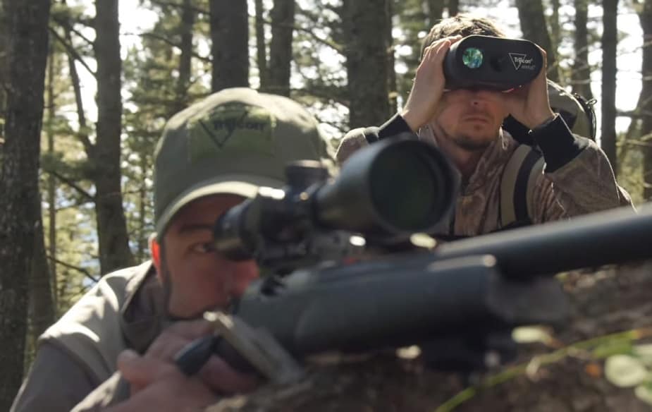
Trijicon's Ventus measures three-dimensional wind velocities at multiple distances out to 500 yards and ranges real-world, non-reflective targets up to 5,000 yards
Feb 25, 2021
Advancing Defense Capability Through Strategic Collaboration
Defense Advancement works with major OEMs to foster collaboration and increase engagement with SMEs, to accelerate innovation and drive defense capabilities forward.