Geolocation Technology and Software for Military Applications
Source geolocation technologies and positioning systems from specialist defense suppliers supporting military platforms and programs. Available solutions include GPS, GNSS, inertial navigation, and resilient PNT hardware and software, all specified for air, land, maritime, space, and dismounted applications. These technologies are selected for integration into UAVs, vehicles, vessels, satellites, and soldier systems that require accuracy, resilience, and assured availability, particularly in contested and GPS-denied environments.
If you design, build or supply Geolocation Technology and Software, create a profile to showcase your capabilities and connect with visitors who have an active requirement for your solutions.
GNSS technology is used to compute position and velocity for a variety of real-time applications,... ...ost-processing software is a powerful, highly configurable processing engine that allows for the...
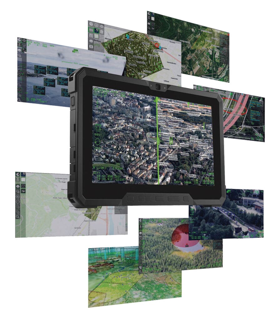
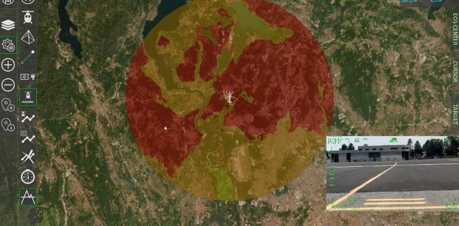
Cutting-edge multi-domain PED software for enhanced situational awareness
Cutting-edge multi-domain PED software for enhanced situational awareness
...ate-of-the-art software uses sophisticated AI and data fusion algorithms to extract critical... ...en and modular software architecture, it is fully customizable and extendable to suit even the most...
Geolocation Technology and Software for Military Applications
Overview by
Eleanor Widdows
Updated:
Geolocation technology enables precise positioning, navigation, and timing (PNT) critical to modern military operations. These systems support location tracking, ISR, command coordination, and situational awareness across air, land, sea, and cyber domains. Designed for resilience and accuracy, they integrate with UAVs, ground vehicles, naval platforms, satellites, and soldier systems. With growing threats like GPS denial and electronic warfare, reliable geolocation is essential for mission success.
Geolocation Technology Use Cases
Geolocation technology can be applied to various military and defense applications, including:
Intelligence, Surveillance, and Reconnaissance (ISR): Geolocation tools enable ISR platforms to geotag imagery and SIGINT data, increasing mission intelligence.
Situational Awareness: Blue force tracking and geospatial data fusion improve visibility across battlefields and command centers.
Asset and Supply Chain Tracking: Enables end-to-end monitoring of logistics and high-value assets across hostile or remote areas.
Search and Rescue (SAR): Supports personnel recovery operations by providing precise localization data, even in GNSS-denied environments.
Command and Control (C2): Enhances C2 systems with geolocation inputs for force movement tracking and mission synchronization.
Border Security and Tactical Surveillance: Assists in persistent monitoring of national boundaries and high-threat areas.
GPS-Denied and Degraded Environments: Provides assured navigation through inertial, hybrid, and signal-based methods where GNSS signals are unavailable or compromised.
Types of Geolocation Systems and Tools
Military geolocation technologies are categorized by signal source, positioning method, and environmental suitability. Each system type offers distinct advantages depending on mission requirements and operating conditions.
GNSS/GPS Navigation and Positioning
GrafNav GNSS Post-Processing Software by NovAtel.
Global Navigation Satellite Systems (GNSS), including the U.S. GPS, Russian GLONASS, European Galileo, and Chinese BeiDou, are foundational to modern military navigation. GNSS provides high-accuracy, global positioning data through satellite constellations.
Military systems often use multi-constellation GNSS receivers to ensure redundancy and signal integrity. Enhancements like WAAS, EGNOS, and GBAS improve accuracy and reliability. Military GPS solutions integrate anti-jamming, anti-spoofing, and encrypted signal support in contested environments to protect operational integrity.
GNSS-based positioning is used extensively in aerial, maritime, and ground operations and is critical for timing synchronization across networked defense platforms.
Cell Tower Triangulation
Cellular triangulation uses signal metrics such as Time of Arrival (TOA), Time Difference of Arrival (TDOA), and Received Signal Strength (RSS) to estimate location based on signals from multiple cell towers. While less precise than GNSS, it offers a fallback solution in GPS-denied urban or indoor environments.
Defense applications include covert tracking, emergency localization, and redundant geolocation in electronic warfare scenarios. Cellular triangulation supports border surveillance and homeland security operations in populated or signal-rich areas.
Wi-Fi Positioning System (WPS)
Wi-Fi Positioning Systems leverage the signal characteristics of surrounding WLAN access points to determine device location. WPS is particularly useful in urban warfare, dense infrastructure, or indoor military facilities.
Military use of WPS is expanding with the integration of Bluetooth Low Energy (BLE) and Wi-Fi RTT (Round Trip Time) methods for indoor positioning, warehouse management, and facility security monitoring. Wi-Fi-based geolocation is also helpful for force protection and base situational awareness, especially when integrated into broader ISR and surveillance frameworks.
Inertial Systems
Inertial Navigation Systems (INS) and Inertial Measurement Units (IMUs) calculate position based on accelerometers and gyroscopes without relying on external signals. INS is essential for GPS-denied navigation, such as in subterranean, underwater, or jamming-prone environments.
Modern military INS systems use FOG (Fiber Optic Gyroscope) and MEMS (Micro-Electro-Mechanical Systems) gyroscope technology to provide compact and precise inertial data. These are commonly embedded in UAVs, guided munitions, and autonomous ground systems.
Indoor positioning systems are designed for location tracking within buildings, tunnels, or other enclosed structures where GNSS signals are weak or blocked. IPS technologies include:
Bluetooth Beacons: Emit low-energy signals to support personnel and asset tracking.
Ultra-Wideband (UWB): Offers centimeter-level precision for indoor movement detection.
Magnetic Field Mapping: Relies on environmental magnetic signatures for unique location determination.
IPS is increasingly deployed in command bunkers, logistics hubs, and maintenance facilities, enhancing operational efficiency and physical security.
Hybrid Systems
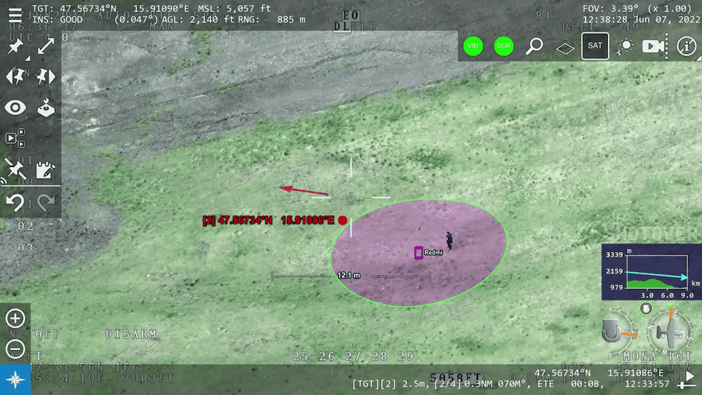
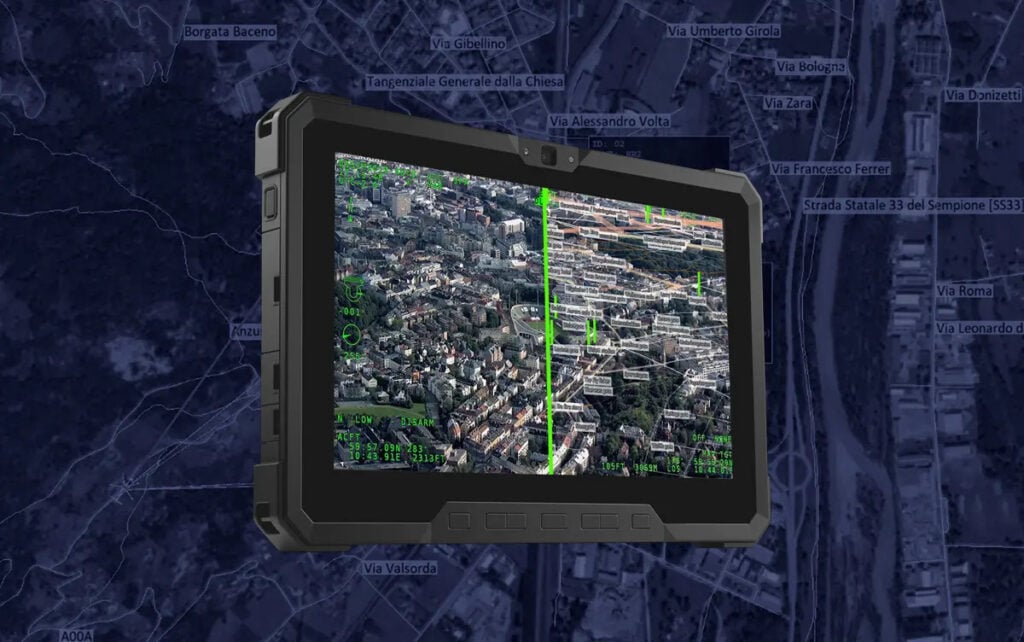
OPENSIGHT multi-domain PED software for enhanced situational awareness by FlySight.
Hybrid positioning systems combine multiple geolocation technologies to provide resilience, redundancy, and precision under variable conditions. Typical hybrid architectures integrate:
GNSS + INS: For continuous navigation with signal correction.
GNSS + Wi-Fi + Cellular: For adaptable performance across indoor and outdoor environments.
TDOA/FDOA/DOA + Signal Processing Software: Enables high-accuracy triangulation using ISR assets or surveillance arrays.
Hybrid systems are critical for missions requiring Assured PNT (A-PNT) capabilities, enabling continued operation under NAVWAR (navigation warfare) conditions.
Geolocation Software
Geolocation software provides the computational backbone for interpreting, visualizing, and distributing positional data across military systems. These platforms support both real-time and post-processed analysis and are critical for signal triangulation, data fusion, and integration with ISR, command, and logistics platforms.
Geolocation software typically includes:
Signal Processing Modules: Handle TDOA, FDOA, DOA, and RSS algorithms for passive and active geolocation.
Mapping and Visualization Interfaces: Offer MGRS-compatible overlays and tactical map integration for operational situational awareness.
Data Fusion Engines: Integrate positional data from GNSS, INS, cellular, Wi-Fi, and other sources to produce coherent and accurate location outputs.
Interoperability Tools: Ensure compliance with STANAG and MIL-STD standards, enabling cross-platform communication and coalition interoperability.
Security Features: Provide encrypted data handling, role-based access control, and audit trails for classified operations.
Military geolocation software is deployed in tactical operation centers, ISR processing units, and C2 networks. It is also embedded in handheld devices, UAV ground stations, and vehicle navigation systems. These tools enhance spatial awareness and precision targeting while enabling real-time decision support across distributed operations.
Key Performance Factors
When assessing geolocation tools for defense applications, critical performance criteria include:
Accuracy: Positioning resolution suitable for targeting, logistics, and search and rescue.
Resilience: Resistance to jamming, spoofing, and signal interference.
Security: Use of encrypted signals, trusted firmware, and secure communications.
Integration: Compatibility with ISR platforms, C2 networks, and coalition systems.
Scalability: Deployable across vehicle fleets, soldiers, and unmanned platforms.
Relevant Standards and Protocols
Military geolocation technology must align with internationally recognized standards to ensure interoperability and mission reliability:
MIL-STD-129 and MIL-STD-2525: Address labeling and geospatial symbology for tracking.
MIL-STD-6016: C2 message formats for location data sharing.
STANAG 4609 and 4586: Geolocation support in ISR video and UAV control systems.
MGRS (Military Grid Reference System): Standard location reference across NATO forces.
Assured PNT Compliance: Requires validated performance under GNSS-degraded conditions.
Emerging Trends in Defense Geolocation
As military operations evolve, so do the demands on geolocation systems. Notable trends include:
AI-Powered Localization: Leveraging machine learning to interpret multi-source signals and improve positioning in complex environments.
Resilient GNSS Receivers: Hardened devices that maintain performance under spoofing and jamming attacks.
Tactical Mesh Networks: Use geolocation-aware nodes for decentralized force coordination.
IoBT (Internet of Battlefield Things): Enables autonomous location awareness across distributed sensors and platforms.
Signal Processing Innovations: Improved algorithms for TDOA/FDOA/DOA to support long-range ISR triangulation.
Strategic Considerations for Procurement
For military procurement officers and engineering teams, geolocation system selection should account for:
Mission profile and operational environment
GPS-denied navigation requirements
Platform-specific integration constraints
Cybersecurity and anti-spoofing capabilities
Lifecycle support and software interoperability
Selecting appropriate geolocation tools enhances force effectiveness, accelerates decision-making, and protects personnel and assets in both conventional and asymmetric warfare environments.
New advancements to the ARTEMIS mobile phone detection system introduce fully passive geolocation capabilities and automated sensor cueing to streamline data delivery for airborne search, rescue, and emergency response operations
FlySight’s OPENSIGHT Mission Console is being integrated within MOSA architecture to demonstrate enhanced interoperability, modularity, and real-time situational awareness for mission and avionics systems
FlySight discusses the impact of tactical edge computing technologies in military environments, enabling real-time data processing, improving operational efficiency, and supporting autonomous systems
FlySight examines recent advancements in ISR and ISTR technologies, highlighting software-driven capabilities, system integration, and the evolving role of AI
Trillium Engineering’s GD-Loc, integrated with the HD55-MV gimbal on a Group 2 UAS, has demonstrated sustained Category 1 geolocation accuracy under GPS-denied conditions, enhancing critical ISR mission capabilities
FlySight explains how its OPENSIGHT Enhanced Reality System delivers layered AR visualization, real-time video enhancements, and customizable overlays for airborne, tactical, and training operations
FlySight’s OPENSIGHT system is advancing Augmented Reality (AR) with solutions that enhance aviation, law enforcement, and training through real-time data integration and improved situational awareness
Teledyne FLIR OEM has unveiled the Prism™ SKR, its latest addition to the Prism embedded software ecosystem
Mar 24, 2025
Advancing Defense Capability Through Strategic Collaboration
Defense Advancement works with major OEMs to foster collaboration and increase engagement with SMEs, to accelerate innovation and drive defense capabilities forward.