FT Technologies’ case study, “UAV-based Atmospheric Sounding System”, explores unmanned aerial vehicles (UAVs) equipped with advanced wind sensors, seen as a promising solution for providing real-time and precise wind data that can support successful rocket launches.
Background
UAV-based atmosphere sounding system developed in Łukasiewicz – Institute of Aviation is the second component of the system (except for atmospheric probing with meteorological balloons) supporting the launch of ILR-33 AMBER rockets.
The monitoring of wind speed and direction is crucial in the first moments of flight, when the rocket velocity is of the same order as the wind speed. The atmospheric wind profile at near-ground altitudes can significantly impact the rocket trajectory. As a result, it is necessary to know this information as accurately as possible to ensure a successful launch.
Traditional near-ground wind data sources, ranging from wind towers to numerical models of the atmosphere, have limitations. Wind towers are costly and unfeasible at many test ranges used for launches, while numerical modeling may not reflect the specific ground profile near the launcher due to their large cell size of the domain (2 to +10km). Meteorological balloons are not suitable for such measurements as they aim to provide the launch operator with a wind profile at high altitudes and are launched only 1–2 times per flight attempt.
Project
This study sought to prototype a wind measurement system designed to acquire near-ground wind profile data. It focused on measuring wind direction and speed at near-ground altitudes with higher flight frequency, offering data on demand shortly prior to the launch. This atmospheric sounding system consists of an Unmanned Aerial Vehicle (UAV) equipped with an onboard ultrasonic wind sensor.
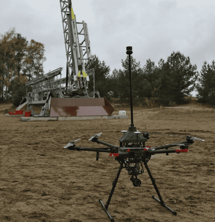
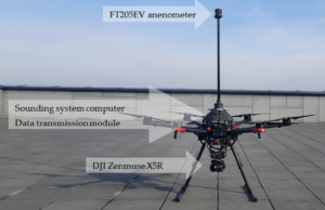
The atmospheric sounding system includes the Unmanned Aerial Vehicle – a DJI Matrice 600 Pro with an FT Technologies FT205EV ultrasonic anemometer, onboard computer, data link and ground control station with software executing a user-defined flight sequence and dedicated software to receive and decode data frames to generate a wind profile graph.
The FT205EV ultrasonic anemometer was securely fastened to the hexacopter structure of the DJI Matrice 600 Pro Unmanned Aerial Vehicle (DJI, Shenzhen, China). To minimize disturbances arising from rotor-generated airflow, the sensor-anemometer was strategically positioned at a safe horizontal and vertical distance from the rotors and propellers. This positioning maintained the alignment with the carrier platform’s axis and ensured parallel orientation with the north direction. The anemometer’s onboard computer frame was fabricated using the Multi Jet Fusion 3D printing method, incorporating composite technology with carbon fiber for the mast and center plate.
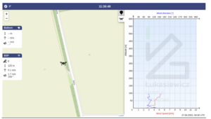
The unmanned aerial system follows a predetermined flight path while the measuring apparatus, which includes the FT205EV sensor, collects and transmits selected atmospheric data to the ground station. The UAV System software, installed on the ground control station, is specifically designed to visualize this data.
The system was tested in real flight conditions, successfully executing automatic flights up to an altitude of 500 meters above ground level. A Specific Operations Risk Assessment (SORA) analysis was done and approval was obtained from the Poland Civil Aviation Authority to carry out the mission. The analysis was conducted in partnership with SORA ASSISTANCE by Łukasiewicz – Institute of Aviation.
Conclusion
The integration of UAVs equipped with advanced wind sensors presents a promising solution for providing real-time and precise wind data that can support successful rocket launches. Accurate wind profiling is a crucial factor in ensuring a high level of safety and success rate for such launches. UAVs equipped with advanced wind sensors, being a cost-effective and efficient solution, can obtain accurate wind data that can help improve the safety of rocket launches.
The prototyped system was successfully used in a suborbital rocket launch campaign, thus demonstrating the feasibility of integrating UAVs with dedicated sensors for performing regular meteorological measurements in automatic mode.


