Next-Generation AI Platform for Space-based Global Monitoring

BlackSky will expand its Spectra AI platform to develop a responsive system that can automatically monitor large-scale construction such as military bases and airports By Joseph Macey / 26 Jan 2021

Discover Leading Defense Technology Solutions

Discover cutting-edge solutions from leading global suppliers
SUPPLIER SPOTLIGHT
Follow DA

BlackSky, a provider of global monitoring services and geospatial insights, has been awarded a multi-phase, multi-year research contract from the Intelligence Advanced Research Projects Activity (IARPA). IARPA is responsible for leading research programs to overcome difficult challenges relevant to the U.S. intelligence community.

BlackSky_ autonomously_monitoring_construction_activity_Flamingo-Bay-Naval-Base-Sudan
BlackSky is autonomously monitoring construction activity at the Flamingo Bay Naval Base in Port Sudan with the power of Spectra AI.

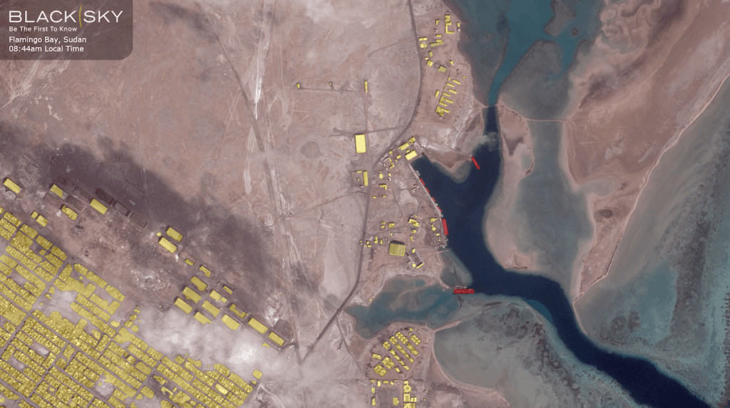
BlackSky has been selected to aid in the development of IARPA’s Space-based Machine Automated Recognition Technique (SMART) Program. The SMART program aims to automate the quantitative analysis of space-based imagery to perform broad-area searches for natural and man-made events using time-series imagery.

BlackSky will expand upon its Spectra AI platform to develop a responsive system that can automatically monitor large-scale construction of critical infrastructure such as military bases, stadiums, campuses, dams, and airports.

“This is a tremendous breakthrough in unsupervised learning for our Spectra AI platform and an unprecedented step toward the future of global monitoring,” said Brian O’Toole, CEO of BlackSky. “The IARPA SMART program is a natural fit for BlackSky given our deep expertise in geospatial analytics and our proven ability to deliver first-to-know insights.”

Under the contract, BlackSky will create open source, supervised, and semi-supervised learning algorithms to recognize data patterns specific to large-scale construction projects. The combined effort will leverage the resources of NASA’s and U.S. Geological Survey Landsat’s constellation and Sentinel, the European space agency’s constellation.

Posted by Joseph Macey Connect & Contact

Latest Articles

GA-ASI & Marine Corps Advance MQ-9A Operational Capabilities

The U.S. Marine Corps has accumulated over 1,000 flight hours using the MQ-9A unmanned aircraft in collaboration with General Atomics Aeronautical Systems, Inc. (GA-ASI)

Apr 30, 2025
New ESTU Module to Boost Short-Term Stability of Optical Cesium Clocks

Adtran has launched the Enhanced Short-Term Unit (ESTU) for its OSA 3300 optical cesium clocks, delivering passive hydrogen maser-level stability and significantly enhancing precision timing for defense applications

Apr 30, 2025
Sky Power to Showcase ISR UAV Propulsion Technology at XPONENTIAL 2025

Sky Power International will present advanced UAV propulsion technologies at XPONENTIAL 2025, highlighting powerful engines, hybrid systems, and customized solutions for ISR and civilian applications

Apr 29, 2025
Full Ground Autonomy Integrated into Army SMET Vehicle for Uncrewed Breaching

Overland AI demonstrated its latest autonomous ground breaching capabilities at Project Convergence Capstone 5, integrating advanced software, hardware, and aerial payloads for Army experimentation

Apr 29, 2025
Application of Wheel Speed Sensors in INS

Micro-Magic delves into how wheel speed sensors are often used as auxiliary sensors in INS to improve navigation accuracy and suppress accumulated errors of inertial sensors

Apr 28, 2025
Product Spotlight: The Honeywell HG4930 IMU

Honeywell highlights the key features and reliability of the Honeywell HG4930 IMU, a trusted solution for navigation in GNSS-denied environments and challenging conditions

Apr 28, 2025

Featured Content

Sky Power to Showcase ISR UAV Propulsion Technology at XPONENTIAL 2025

Sky Power International will present advanced UAV propulsion technologies at XPONENTIAL 2025, highlighting powerful engines, hybrid systems, and customized solutions for ISR and civilian applications

Apr 29, 2025
Q&A with DEFCROS: Key Insights for the 2025 Expo

DEFCROS Founder Kristijan Ilovača discusses the expo’s rapid growth, international ambitions, and how the event aims to support defense and security innovators

Apr 24, 2025
Ophir® FoldIR Lens Enhances Long-Range Imaging for Defense & Security Operations

The new Ophir® FoldIR 25-275mm MWIR zoom lens delivers compact, long-range imaging with low-SWaP performance for drones and small gimbal platforms

Apr 17, 2025
Advancing Defense Capability Through Strategic Collaboration Defense Advancement works with major OEMs to foster collaboration and increase engagement with SMEs, to accelerate innovation and drive defense capabilities forward.