Maxar Awarded Phase 3b of US Army’s World Terrain Contract

The One World Terrain (OWT) prototype provides a realistic, common and automatically generated global geospatial dataset for simulation, mission command and intelligence systems to conduct collective training, mission rehearsal and mission execution By Joseph Macey / 28 Feb 2023

Command and Control Software

Discover cutting-edge solutions from leading global suppliers
SUPPLIER SPOTLIGHT
Follow DA

Maxar Technologies has been awarded Phase 3b of the US Army’s One World Terrain (OWT) prototype Other Transaction Agreement contract.

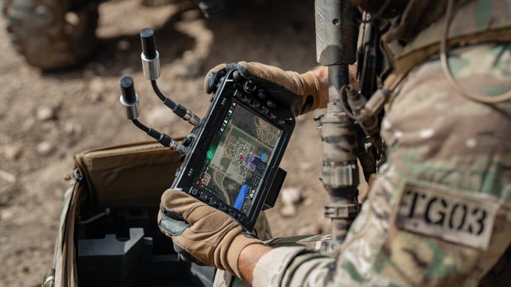
The OWT program delivers 3D global terrain capability and associated information services that support a fully accessible virtual representation of the physical Earth through the Army network.

OWT is seen as a key component of the Army’s Synthetic Training Environment (STE), which provides a realistic, common and automatically generated global geospatial dataset for simulation, mission command and intelligence systems to conduct collective training, mission rehearsal and mission execution at the point of need.

“Maxar is proud to continue as the prime contractor for the One World Terrain program, which supports current and future combat missions and is on track to become the Army’s authoritative source for foundation geospatial content and terrain data—from training to operations and targeting,” said Tony Frazier, Maxar’s Executive Vice President and General Manager, Public Sector Earth Intelligence. “The evolution of OWT shows how 3D terrain and information services are becoming essential tools for planning and decision-making not just for the U.S. Army but for a wide range of military, civil and commercial institutions.”

In 2022, Maxar’s Phase 3a work focused on improving 3D terrain dataset fidelity and refining the automation processes to generate realistic terrain derived from Maxar’s satellite imagery for high-fidelity modeling and simulation systems, as well as terrain data export capability for operational Mission Command Information Systems.

In Phase 3b, Maxar will focus on enhanced conflation with open-source geospatial data and enhanced training areas using multisource collection, high-resolution insets. The OWT prototype will evaluate the use of small unmanned aerial collections and the georegistration of existing US Army terrain datasets.

OWT is a component of the modernization initiative led by the STE Cross Functional Team at Army Futures Command, managed by the Program Executive Office Simulation, Training and Instrumentation and contracted through Army Contracting Command-Orlando. The original OWT contract was awarded in June 2019 to Vricon, which was acquired by Maxar in July 2020.

Posted by Joseph Macey Connect & Contact

Latest Articles

GA-ASI & Marine Corps Advance MQ-9A Operational Capabilities

The U.S. Marine Corps has accumulated over 1,000 flight hours using the MQ-9A unmanned aircraft in collaboration with General Atomics Aeronautical Systems, Inc. (GA-ASI)

Apr 30, 2025
New ESTU Module to Boost Short-Term Stability of Optical Cesium Clocks

Adtran has launched the Enhanced Short-Term Unit (ESTU) for its OSA 3300 optical cesium clocks, delivering passive hydrogen maser-level stability and significantly enhancing precision timing for defense applications

Apr 30, 2025
Sky Power to Showcase ISR UAV Propulsion Technology at XPONENTIAL 2025

Sky Power International will present advanced UAV propulsion technologies at XPONENTIAL 2025, highlighting powerful engines, hybrid systems, and customized solutions for ISR and civilian applications

Apr 29, 2025
Full Ground Autonomy Integrated into Army SMET Vehicle for Uncrewed Breaching

Overland AI demonstrated its latest autonomous ground breaching capabilities at Project Convergence Capstone 5, integrating advanced software, hardware, and aerial payloads for Army experimentation

Apr 29, 2025
Application of Wheel Speed Sensors in INS

Micro-Magic delves into how wheel speed sensors are often used as auxiliary sensors in INS to improve navigation accuracy and suppress accumulated errors of inertial sensors

Apr 28, 2025
Product Spotlight: The Honeywell HG4930 IMU

Honeywell highlights the key features and reliability of the Honeywell HG4930 IMU, a trusted solution for navigation in GNSS-denied environments and challenging conditions

Apr 28, 2025

Featured Content

Sky Power to Showcase ISR UAV Propulsion Technology at XPONENTIAL 2025

Sky Power International will present advanced UAV propulsion technologies at XPONENTIAL 2025, highlighting powerful engines, hybrid systems, and customized solutions for ISR and civilian applications

Apr 29, 2025
Q&A with DEFCROS: Key Insights for the 2025 Expo

DEFCROS Founder Kristijan Ilovača discusses the expo’s rapid growth, international ambitions, and how the event aims to support defense and security innovators

Apr 24, 2025
Ophir® FoldIR Lens Enhances Long-Range Imaging for Defense & Security Operations

The new Ophir® FoldIR 25-275mm MWIR zoom lens delivers compact, long-range imaging with low-SWaP performance for drones and small gimbal platforms

Apr 17, 2025
Advancing Defense Capability Through Strategic Collaboration Defense Advancement works with major OEMs to foster collaboration and increase engagement with SMEs, to accelerate innovation and drive defense capabilities forward.