
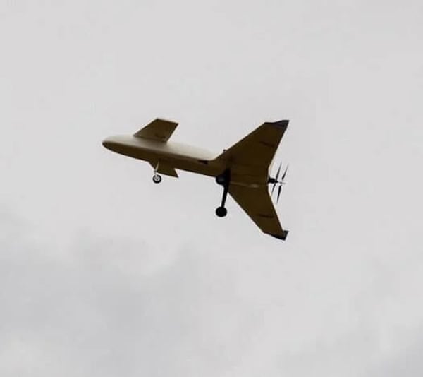
ISR Drones
Discover cutting-edge solutions from 6 leading global suppliers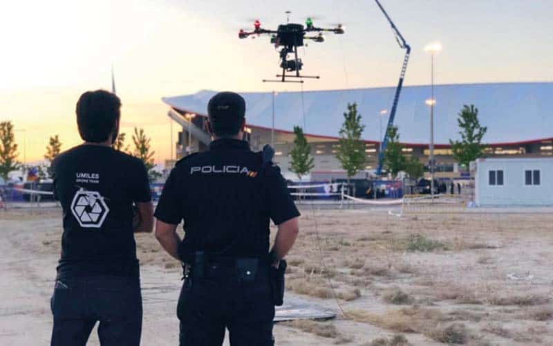
Elistair’s tethered drone technology is part of a new digital era in law enforcement that rethinks how agencies conduct surveillance, respond to emergencies, and maintain operational oversight.
Elistair’s guide “How Drones for Police are Revolutionizing Law Enforcement Operations” outlines how tethered drone soluitons can support a wide range of applications for modern police forces, including persistent aerial surveillance, event security, search and rescue, and accident scene reconstruction.
Persistent Oversight with Tethered Drones
For long-duration policing operations, tethered drones offer unique advantages. These platforms draw continuous power from the ground, enabling sustained flight without interruptions from battery issues. Additionally, the tether provides a secure data link and protects against flyaways—critical for surveillance over crowds or during sensitive operations.
Deployed at large public gatherings, crime scenes, or border monitoring missions, tethered drones can maintain uninterrupted aerial views for hours or even days. This persistent presence not only supports crowd control and threat detection, but also acts as a visible deterrent against criminal activity.
Aerial Surveillance Reimagined
Drones now play a pivotal role in enhancing situational awareness for law enforcement. Their ability to deliver live, real-time imagery from above allows police to assess developing situations instantly, whether responding to crimes in progress or monitoring public events.
Unlike static surveillance cameras, drones offer dynamic, flexible coverage, eliminating blind spots and expanding the range of visibility. This mobile aerial advantage is particularly useful in perimeter security applications, where identifying intrusions or suspicious activity requires constant, wide-angle vigilance.
Seamless Integration with Command Infrastructure
Modern drones are designed to integrate with existing command and control systems. They can feed video and telemetry data directly into centralized monitoring hubs, improving coordination across law enforcement teams. By enhancing the tactical picture, drones allow for faster decision-making and more effective deployment of resources.
This interoperability also supports smart city surveillance strategies, in which drones complement fixed infrastructure to provide an adaptive layer of security coverage.
Ethical Surveillance and Public Trust
Compared to traditional helicopters, drones offer a quieter, more cost-effective, and less intrusive method of aerial monitoring. This shift aligns with the growing emphasis on ethical policing, transparency, and community engagement. Many agencies are now proactively communicating their drone policies to the public, addressing privacy concerns and reinforcing trust.
Real-Time Insight, Rapid Response
Police drones have become indispensable for event security. From concerts to sporting events, these systems provide unparalleled visibility over large crowds, allowing security teams to detect, assess, and respond to incidents in real time.
Equipped with HD cameras, thermal imaging, zoom lenses, and even loudspeakers, drones serve multiple roles—from surveillance to crowd communication. Their ability to spot developing threats before they escalate enhances both safety and operational readiness.
Tethered drones are especially valuable in these situations, offering long-term aerial coverage and stable communication links that are not susceptible to interference or power limitations.
Search and Rescue: Faster, Safer, More Efficient
In search and rescue (SAR) scenarios, time is critical—and drones deliver. Whether locating missing persons in remote terrain or conducting reconnaissance after natural disasters, drones enable rapid situational assessment without endangering first responders.
Thermal imaging payloads allow drones to detect heat signatures through foliage, debris, or darkness. When paired with GPS, high-resolution imagery, and real-time data transmission, drones become force multipliers—covering more ground, faster, with greater precision.
Additionally, drones can carry loudspeakers and spotlights to support nighttime SAR operations or communicate with stranded individuals, improving the chances of a successful outcome.
Traffic Accident Reconstruction and Forensic Mapping
Drones are now a cornerstone of modern traffic incident investigations. With their ability to capture detailed overhead imagery, they allow officers to safely and quickly document accident scenes from angles that ground teams can’t access.
When integrated with 3D mapping software, drones can generate accurate reconstructions of crash scenes, including vehicle positions, debris patterns, and skid marks. This data not only improves investigative accuracy but also supports legal proceedings and insurance assessments.
By dramatically reducing the time needed to survey scenes, drones minimize road closures and keep officers safer, particularly in high-risk environments like highways or nighttime incidents.
Advancing Aerial Surveillance in Modern Policing Operations
As drone capabilities continue to evolve, their role in policing will expand—from supporting tactical operations to automating routine patrols and enhancing predictive analytics. The shift toward drone-enabled law enforcement is not just a matter of efficiency; it is a strategic enhancement to public safety.
By combining aerial flexibility with advanced sensors and communication technologies, police drones are setting a new standard in law enforcement operations—delivering smarter, faster, and safer outcomes.