Accelerate Defense Modernization through Strategic Sourcing
Discover cutting-edge solutions from leading global suppliers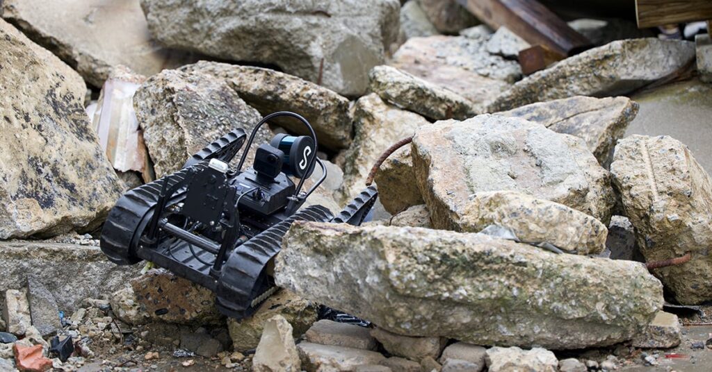
Teledyne FLIR Defense has expanded its Third-Party Payload Integration Program through the certification of Emesent’s Hovermap LiDAR payload to enhance mapping capabilities for unmanned systems.
Unveiled at Modern Day Marine 2026, the agreement integrates Emesent’s 3D-mapping technology across Teledyne FLIR’s unmanned aerial systems, ground robots, and radiation detection platforms. This collaboration is designed to address a critical gap in air and ground domains where GPS connectivity is often lost, such as in tunnels, urban structures, and CBRN-contaminated spaces. By utilizing LiDAR-based Simultaneous Localization and Mapping (SLAM), the Hovermap payload generates precise 3D maps without the need for external infrastructure or GPS signals.
On the SkyRanger R70 and R80D SkyRaider aerial platforms, the technology enables mapping in environments where satellite signals are obstructed. When mounted on the SUGV 325 ground robot, it provides operators with persistent, real-time 3D awareness of complex enclosed spaces. The integration further extends to the MUVE R430 radiation detection payload. By combining these systems on the SUGV, operators can visualize elevated radiation levels within a geo-referenced 3D model of the environment.
Stefan Hrabar, Co-Founder and Chief Strategy Officer at Emesent, said, “Knowing the shape of a space is powerful. Knowing where the radiation is within that space, in real time, without putting a person in harm’s way, is an operational game-changer. Our partnership with Teledyne FLIR Defense brings together GPS-denied mapping and radiation detection in a way that directly addresses what CBRN operators need in the field.”
The certification of Hovermap reflects the success of Teledyne FLIR’s open-architecture development ecosystem. Certified payloads undergo rigorous assessment for mechanical fit, electrical interface, software compatibility, and flight performance to ensure reliable mission-tailored capabilities.
Tung Ng, Vice President of Unmanned Systems North America for Teledyne FLIR Defense, added, “Teledyne FLIR builds platforms trusted for the most demanding CBRN missions in the world. Working with Emesent, we’ll be able to give operators a fused, spatial picture of the threat environment they simply haven’t had access to before.”
“This is the direction the whole field is heading in, and we’re delivering it now through certified third-party payloads like Hovermap,” Ng added.
Beyond current integrations, the partnership establishes a technical foundation for future developments. Both companies are currently working on autonomous navigation capabilities and aim to expand multi-sensor fusion to include additional CBRN detection modalities.