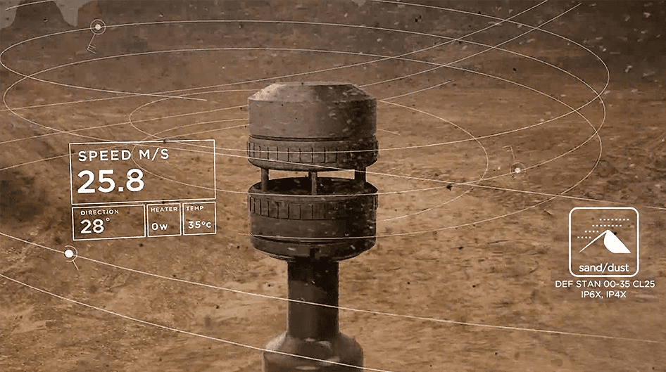
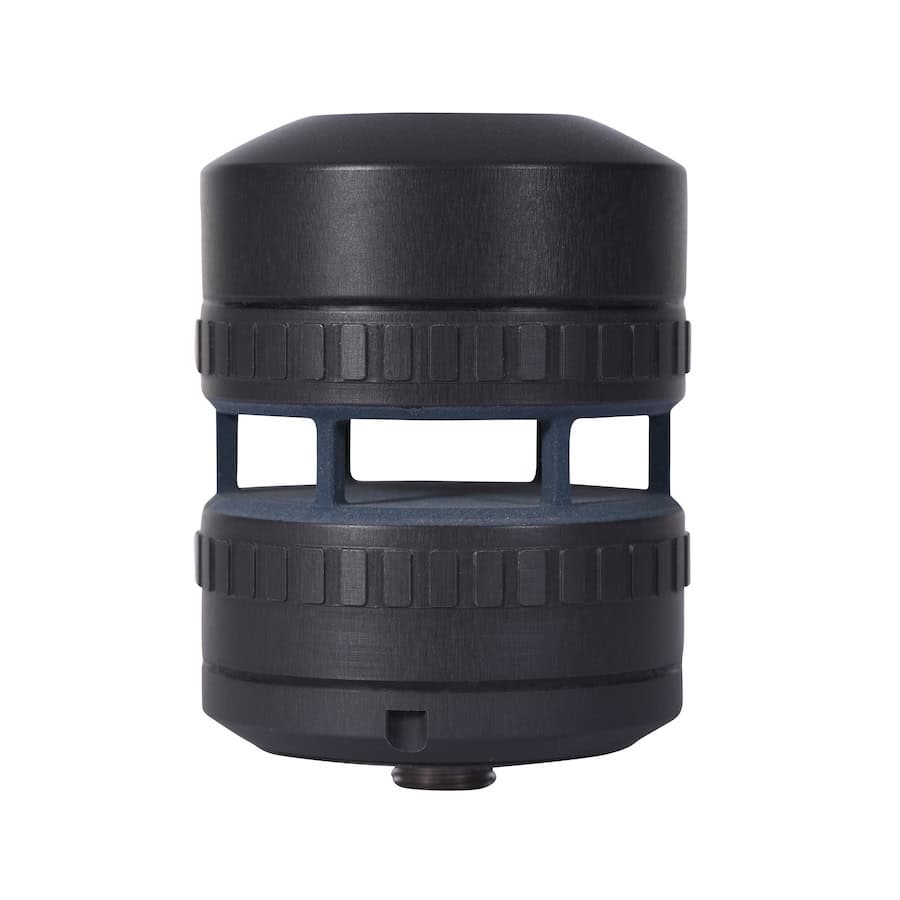
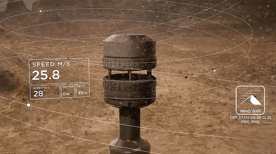
FT Technologies provided its Acoustic Resonance ultrasonic anemometer as part of a UAV-based system designed to deliver real-time wind profile data close to the ground and at altitude.

Integrated into a DJI Matrice 600 Pro platform, the anemometer works with onboard computing and a data link, supported by custom software for flight sequencing and data visualization. The sensor was mounted on a carbon fiber-reinforced, 3D-printed frame to avoid interference from rotor airflow, ensuring stability and accurate alignment.
During operation, the UAV follows a programmed flight path up to 500 meters above ground level, collecting atmospheric information that is transmitted to a ground station for visualization and analysis. This system created a reliable and flexible method of providing wind measurements tailored to the requirements of rocket launch operators.
Background & Challenge
Scout drones provide precise readings of weather and atmospheric conditions at varying elevations, which can be applied to different fields. For instance, drone light shows require confirmation of favorable weather before taking place, since high winds could cause cancellation for safety reasons.

The UAV-based atmospheric sounding solution was developed by Łukasiewicz – Institute of Aviation as a complement to meteorological balloon probing, specifically to support ILR-33 AMBER rocket launches.
Wind speed and direction monitoring is vital in the initial stage of rocket flight when the rocket’s velocity is close to that of wind currents. Near-ground atmospheric wind profiles strongly influence rocket trajectories, making accurate and timely data essential to secure successful launches.
Traditional methods for obtaining near-ground wind data faced limitations:
- Wind towers are expensive and unsuitable for many launch areas.
- Numerical models lack sufficient accuracy close to the launch site due to their wide grid sizes (2–10 km).
- Meteorological balloons, built primarily for high-altitude measurements, usually only allow one or two launches per attempt, which leaves gaps in near-ground data.
This created the need for a cost-effective, high-resolution solution capable of frequent, dependable wind measurements at both near-ground and higher levels. The Scout drone filled this role.
Results
The system underwent successful real-world testing, with the following outcomes:
- Performance: Automatic flights up to 500 meters above ground level were carried out, proving the system’s reliability and accuracy.
- Approval: Authorization was granted by the Poland Civil Aviation Authority following a Specific Operations Risk Assessment (SORA) conducted with SORA ASSISTANCE.
- Application: The UAV-based system was deployed in a suborbital rocket launch campaign, demonstrating its operational effectiveness.
By combining UAVs with advanced wind sensors, this system introduced a new approach to atmospheric monitoring. Delivering accurate, real-time near-ground data, it improved the safety and success rate of rocket launches while also offering a cost-efficient and adaptable solution.
The project proved the practicality of UAVs for automated meteorological measurements and highlighted their potential for broader use in aerospace and atmospheric science.