

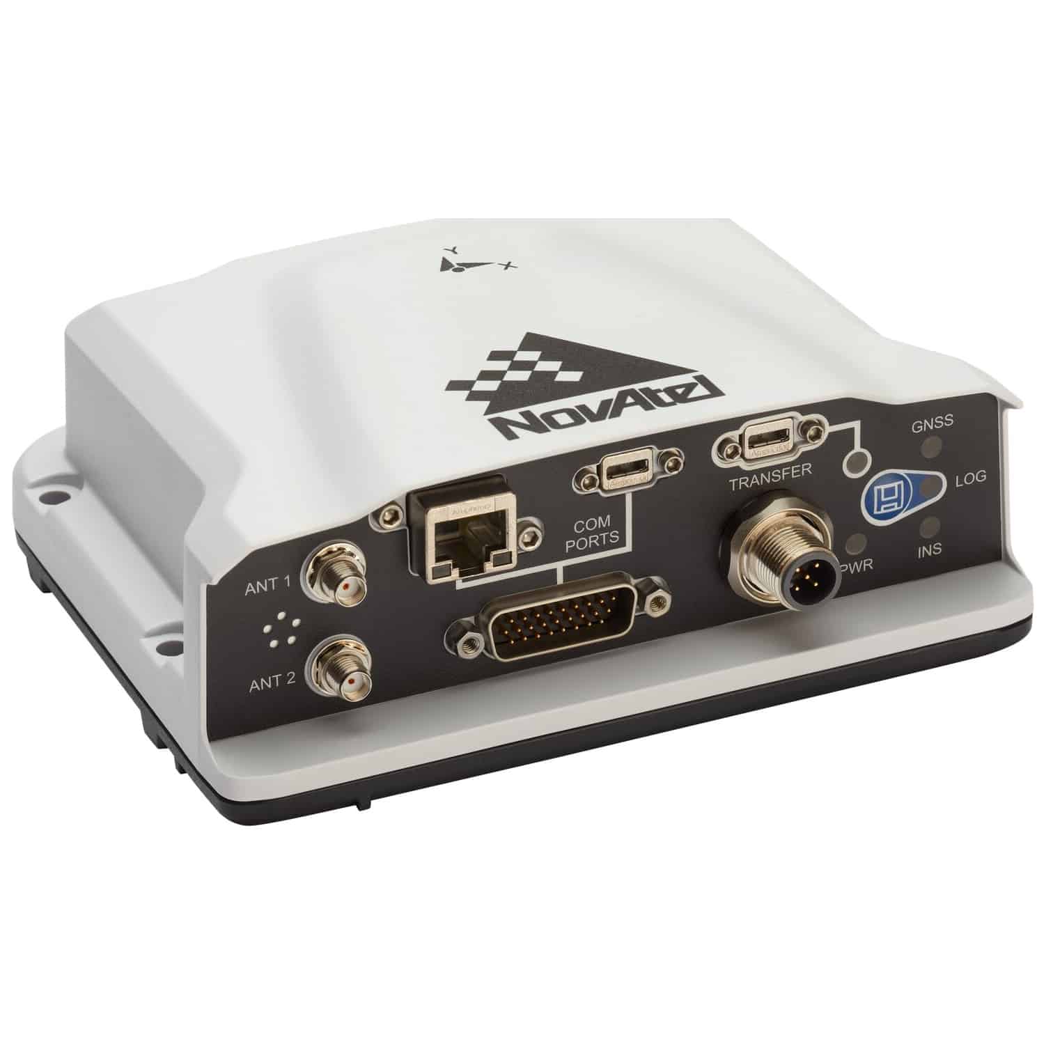
The PwrPak7D-E2 is an advanced OEM7® dual antenna SPAN® GNSS+INS enclosure that provides improved performance and higher data rate. The multi-frequency, dual-antenna input allows the PwrPak7D-E2 to harness the power of NovAtel® CORRECT® with RTK and ALIGN functionality.
The PwrPak7D-E2 contains an Epson G370 MEMS Inertial Measurement Unit (IMU) to deliver world class NovAtel SPAN technology in an integrated, single box solution.
Capable of tracking all present and upcoming GNSS constellations and satellite signals, the PwrPak7D-E2 is software upgradeable and features built-in Wi-Fi, on-board NTRIP client and server support and 16 GB of internal storage.
Features- SPAN enabled enclosure featuring NovAtel’s tightly coupled GNSS+INS engine
- Enhanced connection options including serial, USB, CAN and Ethernet
- Multi-frequency, multi-constellation GNSS receivers offering flexible positioning options and ease of integration
- Multi-channel L-Band supports TerraStar Correction Services
- INS data rates up to 200 Hz
- Multiple communication interfaces for easy integration and installation
- Built in Wi-Fi support
- 16 GB of internal storage
- ALIGN® heading solution
System Type: Enclosed
General Info
Length (mm): 147
Width/Diameter (mm): 125
Height (mm): 55
Weight (g): 560
Typical Power Consumption (w): 4.15
Signal Tracking
GPS: L1 C/A, L1C, L2C, L2P, L5
GLONASS: L1 C/A, L2 C/A, L2 P, L3, L5
BeiDou: B1l, B1C, B2l, B2a, B2b
Galileo: E1, E5 AltBOC, E5a, E5b
SBAS: L1, L5
QZSS: L1 C/A, L1C, L2C, L5
NavIC: L5
L-Band: Up to 5 channels
Number of Com Ports
USB (Device): 1
USB (Host): 1
Ethernet: 10/100 Mbps
CAN Bus: 1 Mbps
Performance
Accuracy (RMS)
Single Point L1: 1.5 m
Single Point L1/L2: 1.2 m
SBAS: 60 cm
DGPS: 40 cm
TerraStar-L: 40 cm
TerraStar-C PRO: 2.5 cm
RTK: 1 cm + 1 ppm


